IMAGES TAKEN NEAR TO
Wesley Street, NOTTINGHAM, NG17 9HN
Introduction
This page details the photographs taken nearby to Wesley Street, NG17 9HN by members of the Geograph project.
The Geograph project started in 2005 with the aim of publishing, organising and preserving representative images for every square kilometre of Great Britain, Ireland and the Isle of Man.

There are currently over 7.5m images from over14,400 individuals and you can help contribute to the project by visiting https://www.geograph.org.uk
Image Map
Images are licensed for reuse under creativecommons.org/licenses/by-sa/2.0
Notes
- Clicking on the map will re-center to the selected point.
- The higher the marker number, the further away the image location is from the centre of the postcode.
Image Listing (28 Images Found)
Images are licensed for reuse under creativecommons.org/licenses/by-sa/2.0
Image
Details
Distance
1
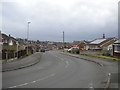
Top of Longhill Rise, Nuncargate
From its end on junction with Wesley Street.
Image: © Richard Vince
Taken: 7 Mar 2020
0.07 miles
2
Kendal Close, Nuncargate
Off Longhill Rise.
Image: © Richard Vince
Taken: 7 Mar 2020
0.09 miles
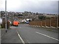
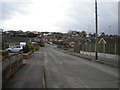
4
Footpath to Cromford Road, Nuncargate
From Derwent Drive.
Image: © Richard Vince
Taken: 7 Mar 2020
0.11 miles
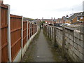
5

Footpath to Sandfield Road, Nuncargate
From the end of Kendal Close.
Image: © Richard Vince
Taken: 7 Mar 2020
0.14 miles
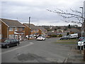
6
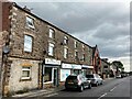
Shops on Forest Road in Annesley Woodhouse
Image: © Jonathan Clitheroe
Taken: 15 Jul 2022
0.14 miles
7
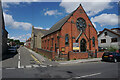
Forest Road Methodist Church
Now closed and the building is up for sale.
Image: © Bill Boaden
Taken: 3 Aug 2022
0.14 miles
9
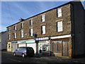
Annesley Woodhouse - chemists on Forest Road
Image: © Dave Bevis
Taken: 8 Dec 2012
0.15 miles
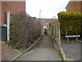
10
Footpath to Nuncargate Road, Nuncargate
From Cromford Road.
Image: © Richard Vince
Taken: 7 Mar 2020
0.15 miles