IMAGES TAKEN NEAR TO
Glamis Close, SUTTON-IN-ASHFIELD, NG17 5LL
Introduction
This page details the photographs taken nearby to Glamis Close, NG17 5LL by members of the Geograph project.
The Geograph project started in 2005 with the aim of publishing, organising and preserving representative images for every square kilometre of Great Britain, Ireland and the Isle of Man.

There are currently over 7.5m images from over14,400 individuals and you can help contribute to the project by visiting https://www.geograph.org.uk
Image Map
Images are licensed for reuse under creativecommons.org/licenses/by-sa/2.0
Notes
- Clicking on the map will re-center to the selected point.
- The higher the marker number, the further away the image location is from the centre of the postcode.
Image Listing (31 Images Found)
Images are licensed for reuse under creativecommons.org/licenses/by-sa/2.0
Image
Details
Distance
1
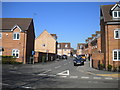
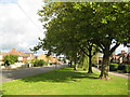
Beginning of Cornmill Road, Sutton Junction
From this junction with Kirkby Folly Road, Cornmill Road twists and turns its way vaguely south west in the sinuous manner of contemporaneous developments.
Image: © Richard Vince
Taken: 5 May 2018
0.06 miles
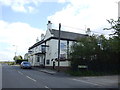
2

The Scruffy Dog, Sutton in Ashfield
According to its own website this pub has been known as the Cart and Horse for over 300 years. Why its current owners - whose objectives seem otherwise entirely admirable - found it necessary to change the name is a mystery.
Image: © Stephen McKay
Taken: 23 Jul 2016
0.10 miles
3

The Scruffy Dog, Sutton in Ashfield
The Scruffy Dog on Station Road is a free house specialising in ales, not food. It was formerly known as the Cart and Horse.
Image: © Stephen McKay
Taken: 23 Jul 2016
0.10 miles
4
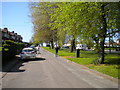
Service road alongside Kirkby Folly Road, Sutton Junction
Looking towards Kirkby.
Image: © Richard Vince
Taken: 5 May 2018
0.10 miles
5
The Cart & Horse Inn
On Station Road, Sutton in Ashfield.
Image: © JThomas
Taken: 18 Apr 2014
0.10 miles
6
Sutton-in-Ashfield - The Cart and Horse Inn
On Station Road.
Image: © Dave Bevis
Taken: 23 Nov 2010
0.10 miles
8
B6021, Kirkby Folly Road
Heading north.
Image: © John Topping
Taken: 25 Jun 2013
0.12 miles
9

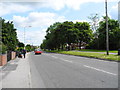
Station Road, Sutton in Ashfield
Despite the road's name, anybody expecting to find Sutton's station here will be disappointed. In fact, until 1964 Sutton Junction station was located just to the south of the level crossing; as the name implies it was a junction with, until 1951, a short branch to the centre of Sutton. The branch passenger service was affectionately known as the 'Penny Emma'. When the line reopened to passengers in 1995 it was decided not to reopen a station at this location but instead Sutton Parkway was opened further to the south
Image: © Stephen McKay
Taken: 23 Jul 2016
0.14 miles
10
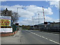
Level crossing on Station Road, Sutton in Ashfield
Heading east.
Image: © JThomas
Taken: 18 Apr 2014
0.14 miles