IMAGES TAKEN NEAR TO
Lansbury Road, SUTTON-IN-ASHFIELD, NG17 5DL
Introduction
This page details the photographs taken nearby to Lansbury Road, NG17 5DL by members of the Geograph project.
The Geograph project started in 2005 with the aim of publishing, organising and preserving representative images for every square kilometre of Great Britain, Ireland and the Isle of Man.

There are currently over 7.5m images from over14,400 individuals and you can help contribute to the project by visiting https://www.geograph.org.uk
Image Map
Images are licensed for reuse under creativecommons.org/licenses/by-sa/2.0
Notes
- Clicking on the map will re-center to the selected point.
- The higher the marker number, the further away the image location is from the centre of the postcode.
Image Listing (4 Images Found)
Images are licensed for reuse under creativecommons.org/licenses/by-sa/2.0
Image
Details
Distance

2
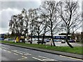
Wickes Store and Food Stand in Sutton in Ashfield
DIY heaven and hell on Station Road.
Image: © Jonathan Clitheroe
Taken: 13 Apr 2022
0.22 miles
3
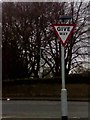
UK Give Way Sign
UK Give Way Sign coming out of Wicks Car Park in Sutton In Ashfield Nottingham Nottinghamshire.
Image: © gary
Taken: 31 Jan 2015
0.25 miles
4

UK Give Way Sign
UK Give Way Sign coming out of Wickes Car Park at Sutton-in-Ashfield Nottingham Nottinghamshire.
Image: © gary
Taken: 31 Jan 2015
0.25 miles