
IMAGES TAKEN NEAR TO
Byron Avenue, SUTTON-IN-ASHFIELD, NG17 4JB
Introduction
This page details the photographs taken nearby to Byron Avenue, NG17 4JB by members of the Geograph project.
The Geograph project started in 2005 with the aim of publishing, organising and preserving representative images for every square kilometre of Great Britain, Ireland and the Isle of Man.

There are currently over 7.5m images from over14,400 individuals and you can help contribute to the project by visiting https://www.geograph.org.uk
Image Map
Images are licensed for reuse under creativecommons.org/licenses/by-sa/2.0
Notes
- Clicking on the map will re-center to the selected point.
- The higher the marker number, the further away the image location is from the centre of the postcode.
Image Listing (17 Images Found)
Images are licensed for reuse under creativecommons.org/licenses/by-sa/2.0
Image
Details
Distance
3
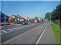
B6023 Mansfield Road
Heading east into the centre of Sutton-in-Ashfield.
Image: © Trevor Rickard
Taken: 10 Sep 2009
0.15 miles
4
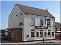
Sutton-in-Ashfield - Speed The Plough
On the north side of Mansfield Road.
Image: © Dave Bevis
Taken: 11 Jun 2015
0.15 miles
5
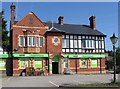
Sutton-in-Ashfield - former The Last Drop
Former pub on the north side of Mansfield Road, now a pet supplies retailer. For a 2009 view of the pub, please see Image
Image: © Dave Bevis
Taken: 11 Jun 2015
0.16 miles
7
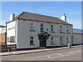
Sutton-in-Ashfield - Oddfellows
Pub on the southern side of Mansfield Road.
Image: © Dave Bevis
Taken: 11 Jun 2015
0.17 miles
8
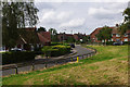
Lawrence Crescent, Sutton in Ashfield
Lawrence Crescent leads off Hill Crescent with open space to the rear of the Mansfield Travelodge Hotel seen here on the right.
Image: © Stephen McKay
Taken: 23 Jul 2016
0.18 miles
9
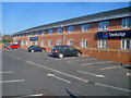
Mansfield Travelodge
This site appears to be empty on the OS maps as at 2009, but there is a large Travelodge (opened in 2005), Tesco Express and a restaurant/bar. Houses on Lawrence Crescent on the left.
Image: © Trevor Rickard
Taken: 10 Sep 2009
0.21 miles
10
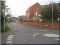
Harriers Grove in Sutton-in-Ashfield
Image: © Peter Robinson
Taken: 1 Aug 2012
0.21 miles