IMAGES TAKEN NEAR TO
Merlin Court, SUTTON-IN-ASHFIELD, NG17 4AE
Introduction
This page details the photographs taken nearby to Merlin Court, NG17 4AE by members of the Geograph project.
The Geograph project started in 2005 with the aim of publishing, organising and preserving representative images for every square kilometre of Great Britain, Ireland and the Isle of Man.

There are currently over 7.5m images from over14,400 individuals and you can help contribute to the project by visiting https://www.geograph.org.uk
Image Map
Images are licensed for reuse under creativecommons.org/licenses/by-sa/2.0
Notes
- Clicking on the map will re-center to the selected point.
- The higher the marker number, the further away the image location is from the centre of the postcode.
Image Listing (15 Images Found)
Images are licensed for reuse under creativecommons.org/licenses/by-sa/2.0
Image
Details
Distance
1
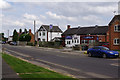
Unwin Road, Sutton in Ashfield
Across the road is Unwin Social Club which is, according to its website, the 'best club in the Sutton area'.
Image: © Stephen McKay
Taken: 23 Jul 2016
0.05 miles
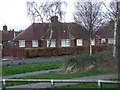
3
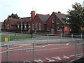
Hillocks Primary School
located on Coxmore Road, Sutton Forest side
Image: © Tom Courtney
Taken: 9 Oct 2005
0.16 miles
4
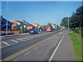
B6023 Mansfield Road
Heading east into the centre of Sutton-in-Ashfield.
Image: © Trevor Rickard
Taken: 10 Sep 2009
0.16 miles
5
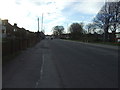
Mansfield Road (B6023)
Heading west towards Sutton-in-Asfield.
Image: © JThomas
Taken: 16 Mar 2014
0.20 miles
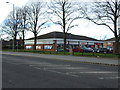
7
Frankie & Benny's at Lakeside Point in Sutton -in-Ashfield
Image: © Peter Robinson
Taken: 1 Aug 2012
0.23 miles
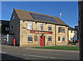
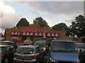
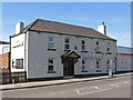
8
Sutton-in-Ashfield - Speed The Plough
On the north side of Mansfield Road.
Image: © Dave Bevis
Taken: 11 Jun 2015
0.23 miles
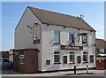
10
Sutton-in-Ashfield - Oddfellows
Pub on the southern side of Mansfield Road.
Image: © Dave Bevis
Taken: 11 Jun 2015
0.24 miles