IMAGES TAKEN NEAR TO
Dale Close, SUTTON-IN-ASHFIELD, NG17 3AF
Introduction
This page details the photographs taken nearby to Dale Close, NG17 3AF by members of the Geograph project.
The Geograph project started in 2005 with the aim of publishing, organising and preserving representative images for every square kilometre of Great Britain, Ireland and the Isle of Man.

There are currently over 7.5m images from over14,400 individuals and you can help contribute to the project by visiting https://www.geograph.org.uk
Image Map
Images are licensed for reuse under creativecommons.org/licenses/by-sa/2.0
Notes
- Clicking on the map will re-center to the selected point.
- The higher the marker number, the further away the image location is from the centre of the postcode.
Image Listing (13 Images Found)
Images are licensed for reuse under creativecommons.org/licenses/by-sa/2.0
Image
Details
Distance
1
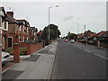
Dalestorth Road
in Sutton in Ashfield, viewed north east
Image: © Tom Courtney
Taken: 9 Oct 2005
0.15 miles
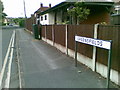
3
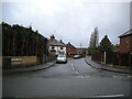
Westdale Avenue, Sutton
Off Dalestorth Road.
Image: © Richard Vince
Taken: 12 Dec 2020
0.17 miles
4
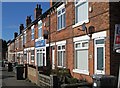
Skegby - terrace at north end of Dalestorth Road
Image: © Dave Bevis
Taken: 24 Feb 2016
0.17 miles
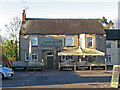
5
Skegby - The Forest Tavern
On Forest Road.
Image: © Dave Bevis
Taken: 1 Dec 2013
0.18 miles
6
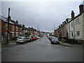
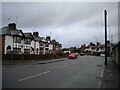
South end of Forest Road, Sutton
Looking towards Skegby from Dalestorth Road.
Image: © Richard Vince
Taken: 12 Dec 2020
0.19 miles
7
Greensfields, near Sutton in Ashfield
Image: © Alex McGregor
Taken: 20 Jun 2011
0.20 miles
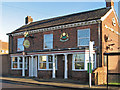
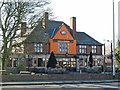
8
Skegby - The Rifle Volunteer on Forest Road
Image: © Dave Bevis
Taken: 1 Dec 2013
0.23 miles
9
Skegby - Fox & Crown
Pub on Mansfield Road.
Image: © Dave Bevis
Taken: 24 Feb 2016
0.24 miles
10
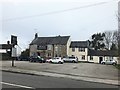
The Rifle Volunteer in Skegby
Located on Forest Road to the north of Sutton in Ashfield. The pub itself (but not the car park) is located in SK4960.
Image: © Jonathan Clitheroe
Taken: 22 Feb 2020
0.24 miles