IMAGES TAKEN NEAR TO
Grange Farm Close, SUTTON-IN-ASHFIELD, NG17 1NJ
Introduction
This page details the photographs taken nearby to Grange Farm Close, NG17 1NJ by members of the Geograph project.
The Geograph project started in 2005 with the aim of publishing, organising and preserving representative images for every square kilometre of Great Britain, Ireland and the Isle of Man.

There are currently over 7.5m images from over14,400 individuals and you can help contribute to the project by visiting https://www.geograph.org.uk
Image Map
Images are licensed for reuse under creativecommons.org/licenses/by-sa/2.0
Notes
- Clicking on the map will re-center to the selected point.
- The higher the marker number, the further away the image location is from the centre of the postcode.
Image Listing (17 Images Found)
Images are licensed for reuse under creativecommons.org/licenses/by-sa/2.0
Image
Details
Distance
1
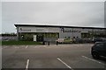
Car Supermarket
Specialising in second hand cars, this is AvailableCar.
Image: © Bob Harvey
Taken: 11 Nov 2015
0.17 miles
2
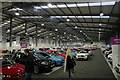
Car Supermarket
This is the interior of the building in Image
Image: © Bob Harvey
Taken: 11 Nov 2015
0.17 miles
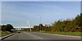
4
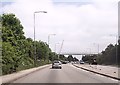
A38 Kings Road, Sutton in Ashfield (3)
View west from the footbridge.
Image: © John Topping
Taken: 25 Jun 2013
0.21 miles
5
Footbridge over A38 near Sutton in Ashfield
Image: © John Firth
Taken: 9 Jun 2013
0.22 miles
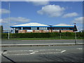
6
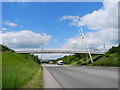
Footbridge over the A38 Kings Road, Sutton in Ashfield
Heading west.
Image: © John Topping
Taken: 25 Jun 2013
0.23 miles
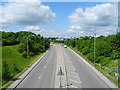
7
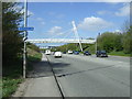
Footbridge over the A38
Heading west towards M1.
Image: © JThomas
Taken: 18 Apr 2014
0.23 miles
9
Footbridge over the Kings Road (A38) Sutton in Ashfield
Image: © Steve Fareham
Taken: 13 Oct 2009
0.23 miles
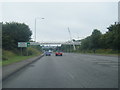
10
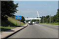
Footbridge on A38
A strikingly designed bridge.
Image: © J.Hannan-Briggs
Taken: 23 Jun 2014
0.23 miles