IMAGES TAKEN NEAR TO
Dovedale Avenue, SUTTON-IN-ASHFIELD, NG17 1DX
Introduction
This page details the photographs taken nearby to Dovedale Avenue, NG17 1DX by members of the Geograph project.
The Geograph project started in 2005 with the aim of publishing, organising and preserving representative images for every square kilometre of Great Britain, Ireland and the Isle of Man.

There are currently over 7.5m images from over14,400 individuals and you can help contribute to the project by visiting https://www.geograph.org.uk
Image Map
Images are licensed for reuse under creativecommons.org/licenses/by-sa/2.0
Notes
- Clicking on the map will re-center to the selected point.
- The higher the marker number, the further away the image location is from the centre of the postcode.
Image Listing (11 Images Found)
Images are licensed for reuse under creativecommons.org/licenses/by-sa/2.0
Image
Details
Distance
1
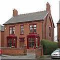
Sutton-in-Ashfield - Kirkby Road - No 86
Image: © Dave Bevis
Taken: 23 Mar 2016
0.15 miles
2
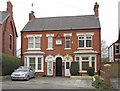
Sutton-in-Ashfield - Kirkby Road - Hawthorne Villas
House numbers 88 and 90. Date-stone shows a building date of 1909.
Image: © Dave Bevis
Taken: 23 Mar 2016
0.15 miles
3
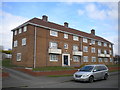
South elevation of West End Court, Sutton in Ashfield
Facing Willowbridge Lane.
Image: © Richard Vince
Taken: 6 Apr 2019
0.16 miles
4
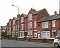
Sutton-in-Ashfield - 3-storey terrace on Kirkby Road
Image: © Dave Bevis
Taken: 23 Mar 2016
0.17 miles
5
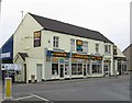
Sutton-in-Ashfield - carpet shop on Kirkby Road
Image: © Dave Bevis
Taken: 23 Mar 2016
0.18 miles
6
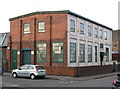
Sutton-in-Ashfield - factory on Craster Street
Image: © Dave Bevis
Taken: 7 Feb 2013
0.21 miles
7
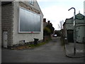
Mayfield Place, Sutton in Ashfield
Sneaking off Church Street.
Image: © Richard Vince
Taken: 6 Apr 2019
0.22 miles
8

Sutton-in-Ashfield - Frank Watts Tyres
On Alfreton Road. The building is dated 1921, according to a stone inscription, but I'm not sure what its original purpose was.
Image: © Dave Bevis
Taken: 7 Nov 2010
0.22 miles
9
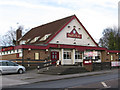
Sutton-in-Ashfield - Staff of Life
Pub on West End.
Image: © Dave Bevis
Taken: 7 Feb 2013
0.23 miles
10
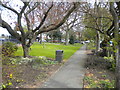
St Mary's Rest Garden, Sutton in Ashfield
In the triangle of Lammas Road (left), Church Street (out of frame to the right), and West End.
Image: © Richard Vince
Taken: 6 Apr 2019
0.24 miles