IMAGES TAKEN NEAR TO
Selston, NOTTINGHAM, NG16 6BG
Introduction
This page details the photographs taken nearby to NG16 6BG by members of the Geograph project.
The Geograph project started in 2005 with the aim of publishing, organising and preserving representative images for every square kilometre of Great Britain, Ireland and the Isle of Man.

There are currently over 7.5m images from over14,400 individuals and you can help contribute to the project by visiting https://www.geograph.org.uk
Image Map
Images are licensed for reuse under creativecommons.org/licenses/by-sa/2.0
Notes
- Clicking on the map will re-center to the selected point.
- The higher the marker number, the further away the image location is from the centre of the postcode.
Image Listing (9 Images Found)
Images are licensed for reuse under creativecommons.org/licenses/by-sa/2.0
Image
Details
Distance
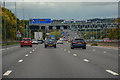
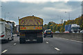
1

Selston : M1 Motorway
Heading north on the M1 Motorway.
Image: © Lewis Clarke
Taken: 20 Sep 2020
0.07 miles
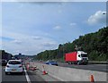
2
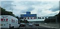
M1 north traffic jam, heading towards junction 28
Image: © Steve Fareham
Taken: 24 Jun 2011
0.08 miles
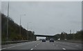
3
M1 Motorway, Nottinghamshire
heading north
Image: © Tom Courtney
Taken: 28 Aug 2005
0.10 miles
4
Concrete central crash barrier on M1
In the background the tip is now green compare Image
Image: © Steve Fareham
Taken: 21 May 2014
0.13 miles
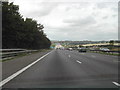
5
Ashfield : M1 Motorway
The M1 Motorway between Junction 27 and Junction 28.
Image: © Lewis Clarke
Taken: 30 Sep 2018
0.16 miles
6
Ashfield : M1 Motorway
The M1 Motorway between Junction 28 and Junction 27.
Image: © Lewis Clarke
Taken: 3 Oct 2018
0.17 miles
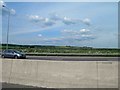
9
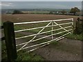
Gate and fields, Selston
Looking north east towards what is noted as Kirkby Park on the 1:25k map. The M1 (J28) just appears on the left of the picture.
Image: © Katy Walters
Taken: 4 Dec 2005
0.24 miles