IMAGES TAKEN NEAR TO
Frost Avenue, NOTTINGHAM, NG16 4GB
Introduction
This page details the photographs taken nearby to Frost Avenue, NG16 4GB by members of the Geograph project.
The Geograph project started in 2005 with the aim of publishing, organising and preserving representative images for every square kilometre of Great Britain, Ireland and the Isle of Man.

There are currently over 7.5m images from over14,400 individuals and you can help contribute to the project by visiting https://www.geograph.org.uk
Image Map
Images are licensed for reuse under creativecommons.org/licenses/by-sa/2.0
Notes
- Clicking on the map will re-center to the selected point.
- The higher the marker number, the further away the image location is from the centre of the postcode.
Image Listing (12 Images Found)
Images are licensed for reuse under creativecommons.org/licenses/by-sa/2.0
Image
Details
Distance
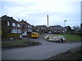
1
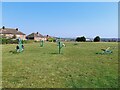
Outdoor gym in Aldercar Recreation Ground
Image: © Ian Calderwood
Taken: 6 Sep 2024
0.13 miles
2
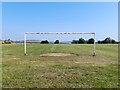
Football pitch in Aldercar Recreation Ground
Freshly white-lined for the new season.
Image: © Ian Calderwood
Taken: 6 Sep 2024
0.15 miles
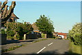
3
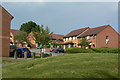
The end of Bailey Brook Drive
New housing at the west end of Aldercar.
Image: © Alan Murray-Rust
Taken: 2 Jun 2010
0.16 miles
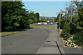
4
Homestead, Aldercar
A short residential cul de sac off Godkin Drive.
Image: © Richard Vince
Taken: 23 Jan 2016
0.18 miles
5
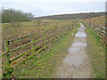
Byway at Loscoe Fields
Looking north-west across common land which was once the site of the Loscoe Colliery which closed in 1933.
Image: © Trevor Rickard
Taken: 28 Feb 2011
0.21 miles
6
Top of Cromford Road
When the Langley Mill Bypass was opened, a new junction was created, leaving this little section as a backwater.
Image: © Alan Murray-Rust
Taken: 16 Jun 2010
0.21 miles
7
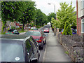
Lower Dunstead Road Langley Mill
Looking Northwards. Pic by Tom
Image: © Q
Taken: 13 Jun 2005
0.22 miles
8
Service road alongside Cromford Road
Built when Cromford Road was the main route (A610) northwest from Nottingham. Since the construction of the Langley Mill bypass, the main carriageway itself sees relatively little traffic.
Image: © Alan Murray-Rust
Taken: 16 Jun 2010
0.22 miles
9
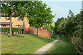
Path at Aldercar
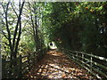
This section of the path follows the alignment of the old mineral railway which served Bailey Brook, Ormonde and Loscoe Collieries.
Image: © Alan Murray-Rust
Taken: 2 Jun 2010
0.22 miles