IMAGES TAKEN NEAR TO
Bacon Close, NOTTINGHAM, NG16 2UW
Introduction
This page details the photographs taken nearby to Bacon Close, NG16 2UW by members of the Geograph project.
The Geograph project started in 2005 with the aim of publishing, organising and preserving representative images for every square kilometre of Great Britain, Ireland and the Isle of Man.

There are currently over 7.5m images from over14,400 individuals and you can help contribute to the project by visiting https://www.geograph.org.uk
Image Map
Images are licensed for reuse under creativecommons.org/licenses/by-sa/2.0
Notes
- Clicking on the map will re-center to the selected point.
- The higher the marker number, the further away the image location is from the centre of the postcode.
Image Listing (10 Images Found)
Images are licensed for reuse under creativecommons.org/licenses/by-sa/2.0
Image
Details
Distance
1
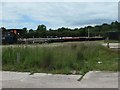
Houses on Wessex Drive, Eastwood
Looking north from a bridleway, across the A610. The houses have been built since 1999.
Image: © Christine Johnstone
Taken: 21 Jun 2019
0.08 miles
2
View towards Newthorpe Common
The bridge crosses the A610 at this point.
Image: © Alan Heardman
Taken: 29 Oct 2008
0.16 miles
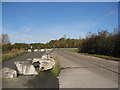
3
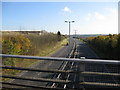
A610 - View from Footbridge near Newthorpe Common
Image: © Alan Heardman
Taken: 29 Oct 2008
0.17 miles
4
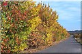
Autumn Hedge, Newthorpe
The lane leads to a Sports Ground to the right of this picture which covers an area where the disused Nottingham Canal used to be. The colourful hedge shields the ground from the busy A610 dual carriageway on the left.
Image: © Garth Newton
Taken: 22 Oct 2003
0.18 miles
5
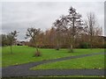
East end of Birnham Park sports ground
The NDOR [Notts & Derby Off Road] RC race track. Seen from the bridleway outside the perimeter fence.
Image: © Christine Johnstone
Taken: 21 Jun 2019
0.20 miles
7
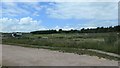
West end of Birnham Park sports ground
Football pitch used by Moorgreen Colts Football Club. Seen from the bridleway outside the perimeter fence.
Image: © Christine Johnstone
Taken: 21 Jun 2019
0.20 miles
8
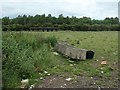
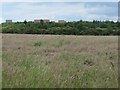
Building in a field, on the south side of the A610
I thought it was a stable, but there is no gate to keep any horses in the field.
Image: © Christine Johnstone
Taken: 21 Jun 2019
0.21 miles
9
Smithurst Meadows
A local nature reserve in Giltbrook
Image: © Graham Hogg
Taken: 13 Dec 2021
0.21 miles
10
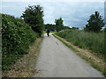
Cyclist heading north on the bridleway
Near Birnham Park sports ground.
Image: © Christine Johnstone
Taken: 21 Jun 2019
0.24 miles