IMAGES TAKEN NEAR TO
Angus Close, NOTTINGHAM, NG16 2GX
Introduction
This page details the photographs taken nearby to Angus Close, NG16 2GX by members of the Geograph project.
The Geograph project started in 2005 with the aim of publishing, organising and preserving representative images for every square kilometre of Great Britain, Ireland and the Isle of Man.

There are currently over 7.5m images from over14,400 individuals and you can help contribute to the project by visiting https://www.geograph.org.uk
Image Map
Images are licensed for reuse under creativecommons.org/licenses/by-sa/2.0
Notes
- Clicking on the map will re-center to the selected point.
- The higher the marker number, the further away the image location is from the centre of the postcode.
Image Listing (58 Images Found)
Images are licensed for reuse under creativecommons.org/licenses/by-sa/2.0
Image
Details
Distance
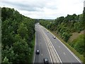
3
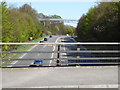
View of footbridge over A610 from Swingate bridge
View from Swingate bridge looking towards M1 junction 26 towards Nottingham
Image: © Neil Robinson
Taken: 18 Apr 2015
0.07 miles
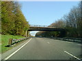
4
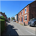
Swingate: up Little Lane
Quarter to nine on a lovely July evening.
Image: © John Sutton
Taken: 5 Jul 2016
0.09 miles
5
Swingate: up Little Lane
Looking towards Spring Hill on a hot June morning.
Image: © John Sutton
Taken: 26 Jun 2018
0.09 miles
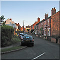
6
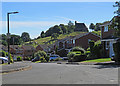
Kimberley: Chapter Drive and the Cemetery
A view taken against the light on a lovely June morning.
Image: © John Sutton
Taken: 26 Jun 2018
0.11 miles
7
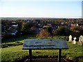
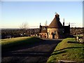
Kimberley from the cemetery
The cemetery is perched on a hill in the centre of Kimberley, with wide-ranging views of the town and beyond, especially on a clear day. Beyond the far edge of the cemetery can be seen the local Sainsbury's, built on the site of the old Wolsey factory. Kimberley is mentioned in the Domesday Survey of 1086 as "Chinemarelie". The hills on the horizon are in Derbyshire.
Image: © Lynne Kirton
Taken: 13 Nov 2010
0.11 miles
8
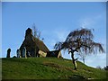
Chapel and tree, Kimberley cemetery
The little chapel in Kimberley cemetery is a local landmark, sited as it is on top of a hill in the middle of the town.
Image: © Lynne Kirton
Taken: 13 Nov 2010
0.12 miles
9
Kimberley cemetery and chapel
The little cemetery chapel is a prominent landmark in Kimberley, commanding wide-ranging views over the town and beyond.
Image: © Lynne Kirton
Taken: 13 Nov 2010
0.12 miles
10
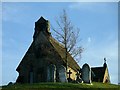
Kimberley cemetery chapel
The little chapel in Kimberley cemetery, with its attendant cluster of gravestones, sits atop its hill overlooking the town, on a beautiful late autumn day.
Image: © Lynne Kirton
Taken: 13 Nov 2010
0.12 miles