
IMAGES TAKEN NEAR TO
Gunnersbury Way, NOTTINGHAM, NG16 1QD
Introduction
This page details the photographs taken nearby to Gunnersbury Way, NG16 1QD by members of the Geograph project.
The Geograph project started in 2005 with the aim of publishing, organising and preserving representative images for every square kilometre of Great Britain, Ireland and the Isle of Man.

There are currently over 7.5m images from over14,400 individuals and you can help contribute to the project by visiting https://www.geograph.org.uk
Image Map
Images are licensed for reuse under creativecommons.org/licenses/by-sa/2.0
Notes
- Clicking on the map will re-center to the selected point.
- The higher the marker number, the further away the image location is from the centre of the postcode.
Image Listing (5 Images Found)
Images are licensed for reuse under creativecommons.org/licenses/by-sa/2.0
Image
Details
Distance
1
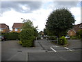
Cut through, Assarts Farm
This pedestrian cut through links Arnos Grove (foreground) with Highbury Close, both of which appear (like most roads on this estate) to be named after London Underground stations.
Image: © Richard Vince
Taken: 28 Jul 2013
0.07 miles
2
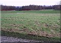
Open space, Broxtowe country park
The red bushes in the background are dogwood, in their winter plumage.
Image: © Lynne Kirton
Taken: 1 Jan 2006
0.17 miles
3
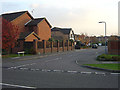
Croxley Gardens, Assarts Farm Estate
This is a typical cul-de-sac in this estate. The road gets its name from the eponymous London Underground Station, as do all the roads on the estate bar one. Some, such as Willesden Green and Arnos Grove, represent the entire name. The road in the foreground is Mornington Crescent.
Image: © Alan Murray-Rust
Taken: 4 Nov 2007
0.22 miles
4
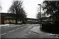
Cranwell Road
On the western edge of the Broxtowe Estate, Nottingham.
The Borough of Broxtowe does not include the district of Broxtowe, it is within the boundaries of the City of Nottingham.
Image: © David Lally
Taken: 15 Jan 2010
0.25 miles
5
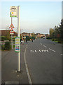
Bus stop "Canterbury Close", Assarts Farm Estate.
The main road here is Mornington Crescent. All the other roads on the estate are named after London Underground stations with the exception of Canterbury Close, the name of which is just legible on the stop plate.
Image: © Alan Murray-Rust
Taken: 4 Nov 2007
0.25 miles