IMAGES TAKEN NEAR TO
Albert Avenue, NOTTINGHAM, NG16 1DZ
Introduction
This page details the photographs taken nearby to Albert Avenue, NG16 1DZ by members of the Geograph project.
The Geograph project started in 2005 with the aim of publishing, organising and preserving representative images for every square kilometre of Great Britain, Ireland and the Isle of Man.

There are currently over 7.5m images from over14,400 individuals and you can help contribute to the project by visiting https://www.geograph.org.uk
Image Map
Images are licensed for reuse under creativecommons.org/licenses/by-sa/2.0
Notes
- Clicking on the map will re-center to the selected point.
- The higher the marker number, the further away the image location is from the centre of the postcode.
Image Listing (14 Images Found)
Images are licensed for reuse under creativecommons.org/licenses/by-sa/2.0
Image
Details
Distance
1
Disused railway
At the top of Albert Avenue in Nuthall, the old railway has been turned into a footpath and recreational area.
Image: © Tom Courtney
Taken: 5 Sep 2005
0.05 miles
2
Main Road, Watnall
The main road from Nottingham to Alfreton, now the B600.
Image: © Alan Murray-Rust
Taken: 21 May 2010
0.07 miles
4
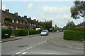
St Patrick's Road
The change in house design compared with the rest of the road to the east http://www.geograph.org.uk/photo/1876261 marks this part of the Larkfields Estate as having been developed by the local Council.
Image: © Alan Murray-Rust
Taken: 21 May 2010
0.15 miles
5
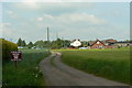
Redfield House Farm
Seen from New Farm Lane.
Image: © Alan Murray-Rust
Taken: 21 May 2010
0.16 miles
6
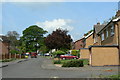
Ayscough Avenue
Modern housing on the north side of Nuthall.
Image: © Alan Murray-Rust
Taken: 21 May 2010
0.21 miles
8
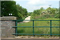
Nuthall Railway Multi-user Access Route
A recently developed path along an old railway line, it currently does not feature on OS maps. This is the view looking west from New Farm Lane. The former railway cutting has been completely filled in at this point.
Image: © Alan Murray-Rust
Taken: 21 May 2010
0.23 miles
9
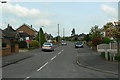
Philip Avenue
Further up this becomes St. Patrick's Road http://www.geograph.org.uk/photo/1876262, marking the difference between the private and council parts of the Larkfields estate.
Image: © Alan Murray-Rust
Taken: 21 May 2010
0.23 miles