IMAGES TAKEN NEAR TO
Swinton Rise, NOTTINGHAM, NG15 9FR
Introduction
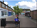
This page details the photographs taken nearby to Swinton Rise, NG15 9FR by members of the Geograph project.
The Geograph project started in 2005 with the aim of publishing, organising and preserving representative images for every square kilometre of Great Britain, Ireland and the Isle of Man.

There are currently over 7.5m images from over14,400 individuals and you can help contribute to the project by visiting https://www.geograph.org.uk
Image Map
Images are licensed for reuse under creativecommons.org/licenses/by-sa/2.0
Notes
- Clicking on the map will re-center to the selected point.
- The higher the marker number, the further away the image location is from the centre of the postcode.
Image Listing (2 Images Found)
Images are licensed for reuse under creativecommons.org/licenses/by-sa/2.0
Image
Details
Distance
1
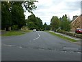
Church Drive, Ravenshead
It forms part of National Cycle Route 6.
Image: © Alan Murray-Rust
Taken: 15 Sep 2019
0.22 miles