1
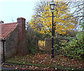
Cycle and foot path
South of Linby, and part of national cycle route 6.
Image: © David Lally
Taken: 27 Apr 2017
0.04 miles
2
Site of Linby Colliery 1873-1988
The plaque states that in the early 1960s Linby was recognised as Britain's 'Champion Pit', and the most efficient coal mine in Europe. Peak output was achieved in 1963 when 1113 men produced 1,325,675 tons
Image: © Tim Heaton
Taken: 11 Nov 2012
0.09 miles
3
Linby Colliery memorial plaque
For a long shot see
Image
The text is:
"Site of Linby Colliery 1873-1988. Reclaimed in 1992-94 by Nottinghamshire County Council. In the early 1960's Linby was recognised as Britain's 'champion pit' and was the most efficient coal mine in Europe. Peak output was achieved in 1963 when 1113 men produced 1,325,675 tons.".
Image: © David Lally
Taken: 27 Apr 2017
0.09 miles
4
Linby Colliery Memorial
About all that is left on the site of the Linby Colliery is this memorial next to the village sports ground. It reads "Site of Linby Colliery 1873-1988. Reclaimed in 1992-94 by Nottinghamshire County Council. In the early 1960's Linby was recognised as Britain's 'champion pit' and was the most efficient coal mine in Europe. Peak output was achieved in 1963 when 1113 men produced 1,325,675 tons.".
Image: © Trevor Rickard
Taken: 18 Sep 2010
0.10 miles
5
St Michael's Church, Linby
Image: © Oxymoron
Taken: 6 Oct 2008
0.11 miles
6
Sports field at Linby
Looking south across the football pitch. Home of Linby Colliery Welfare FC and once part of the Linby colliery site.
Image: © Trevor Rickard
Taken: 18 Sep 2010
0.11 miles
7
St Michael's church tower at Linby
At the B6011 roundabout, with Main Street off to the left.
Image: © Trevor Rickard
Taken: 7 Nov 2009
0.11 miles
8
Linby, NG15
A side gate leading into the graveyard of St Michael's Church from Church Lane. Scores of pauper children, who were drafted in from London workhouses to work in Robinson's cotton mill in Papplewick and who died prematurely, are buried in this graveyard, as opposed to being buried in Papplewick church graveyard. George Robertson (1748-98) came from Aberdeenshire (formerly Kincardineshire) in 1737 and settled in Bulwell. It seems that because there was a strong prejudice against Scots in England at that time, he adopted the English name of Robinson. When he died he left £50 to "poor widows for Christmas". His tomb in the churchyard declares that "He lived a bright example of industry, and every Christian virtue" !
Image: © David Hallam-Jones
Taken: 17 Nov 2012
0.11 miles
9
Waterloo Road
Forms part of the National Cycle Network Route 6.
Image: © David Lally
Taken: 27 Apr 2017
0.12 miles
10
Interior of the Church of St Michael & St James, Linby cum Papplewick
Lady chapel, in the south aisle.
Image: © Dave Hitchborne
Taken: 7 Apr 2007
0.12 miles


