
IMAGES TAKEN NEAR TO
Chatsworth Drive, NOTTINGHAM, NG15 7NW
Introduction
This page details the photographs taken nearby to Chatsworth Drive, NG15 7NW by members of the Geograph project.
The Geograph project started in 2005 with the aim of publishing, organising and preserving representative images for every square kilometre of Great Britain, Ireland and the Isle of Man.

There are currently over 7.5m images from over14,400 individuals and you can help contribute to the project by visiting https://www.geograph.org.uk
Image Map
Images are licensed for reuse under creativecommons.org/licenses/by-sa/2.0
Notes
- Clicking on the map will re-center to the selected point.
- The higher the marker number, the further away the image location is from the centre of the postcode.
Image Listing (64 Images Found)
Images are licensed for reuse under creativecommons.org/licenses/by-sa/2.0
Image
Details
Distance
1

Church of the Holy Cross, Watnall Road, Hucknall
The west front. The mosaic over the door depicts the arms of the monks of Newstead Abbey, commissioned by a visitor to the church from Denmark.
Image: © Alan Murray-Rust
Taken: 21 Jul 2025
0.05 miles
2
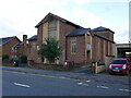
Holy Cross church, Hucknall
Dates from 1959.
Image: © Jonathan Thacker
Taken: 5 Nov 2023
0.05 miles
3

Church of the Holy Cross, Watnall Road, Hucknall
Built in 1959 when the then church was considered too small. The ‘Taking Stock’ website of the Roman Catholic Church describes it as ‘unremarkable’. Architects Reynolds & Scott of Manchester.
Image: © Alan Murray-Rust
Taken: 21 Jul 2025
0.05 miles
4

Datestone on retail premises, Watnall Road
See https://www.geograph.org.uk/photo/8108064 for location.
Image: © Alan Murray-Rust
Taken: 21 Jul 2025
0.06 miles
5
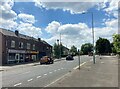
Row of Shops on Watnall Road, Hucklow
Image: © Jonathan Clitheroe
Taken: 14 Jun 2022
0.06 miles
6

Watnall Road Car Centre and Cassidy’s Kitchen, Hucknall
Dated 1930 https://www.geograph.org.uk/photo/8108065 , this has the hallmarks of having been a local co-operative branch, probably with butchery department in the smaller section separate from the grocery side.
Image: © Alan Murray-Rust
Taken: 21 Jul 2025
0.06 miles
8

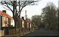
Central Buildings, Watnall Road, Hucknall
Dated 1931 and clearly built to serve the expanding town. The name almost certainly refers to the neighbouring Hucknall Central Station, which itself was far from central to the town but took its name from being the station of the Great Central Railway.
Image: © Alan Murray-Rust
Taken: 21 Jul 2025
0.08 miles
10

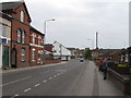
The Central, Watnall Road, Hucknall
Older OS mapping shows the lower building as a club, which presumably at some stage expanded into the adjacent house. The sign on the fence proclaims that it is now a public house rather than a club restricted to members.
Image: © Alan Murray-Rust
Taken: 21 Jul 2025
0.10 miles