IMAGES TAKEN NEAR TO
Maple Leaf Way, NOTTINGHAM, NG15 7ER

Introduction

This page details the photographs taken nearby to Maple Leaf Way, NG15 7ER by members of the Geograph project.

The Geograph project started in 2005 with the aim of publishing, organising and preserving representative images for every square kilometre of Great Britain, Ireland and the Isle of Man.

There are currently over 7.5m images from over14,400 individuals and you can help contribute to the project by visiting https://www.geograph.org.uk

Image Map


Images are licensed for reuse under creativecommons.org/licenses/by-sa/2.0
Notes
  • Clicking on the map will re-center to the selected point.
  • The higher the marker number, the further away the image location is from the centre of the postcode.

Image Listing (6 Images Found)

Images are licensed for reuse under creativecommons.org/licenses/by-sa/2.0
Image
Details
Distance
1
The Bowman Premier Travel Inn, Hucknall
View from the door of room 28 looking towards the door to reception. Pity the views from the bedroom window was dominated by the construction of a housing estate.
Image: © Tony Wheeler Taken: 23 Jun 2007
0.05 miles
2
The Bowman
Eating house and pub next to the Premier Inn on Nottingham Road.
Image: © Trevor Rickard Taken: 1 Aug 2009
0.10 miles
3
The Bowman
Image: © David Lally Taken: 28 Jul 2023
0.10 miles
4
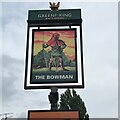
The sign of The Bowman
See Image
Image: © David Lally Taken: 28 Jul 2023
0.12 miles
5
Cycle Route in Bestwood Country Park
Alongside Mill Lakes
Image: © Tim Heaton Taken: 11 Nov 2012
0.20 miles
6
Level crossing at Butlers Hill
Level crossings on the tramway are complicated by the parallel running to the railway, which has to maintain a stricter set of requirements than would have been necessary for the tram alone.
Image: © Alan Murray-Rust Taken: 13 Jan 2008
0.25 miles