IMAGES TAKEN NEAR TO
Poets Close, NOTTINGHAM, NG15 6WF
Introduction
This page details the photographs taken nearby to Poets Close, NG15 6WF by members of the Geograph project.
The Geograph project started in 2005 with the aim of publishing, organising and preserving representative images for every square kilometre of Great Britain, Ireland and the Isle of Man.

There are currently over 7.5m images from over14,400 individuals and you can help contribute to the project by visiting https://www.geograph.org.uk
Image Map
Images are licensed for reuse under creativecommons.org/licenses/by-sa/2.0
Notes
- Clicking on the map will re-center to the selected point.
- The higher the marker number, the further away the image location is from the centre of the postcode.
Image Listing (16 Images Found)
Images are licensed for reuse under creativecommons.org/licenses/by-sa/2.0
Image
Details
Distance
1
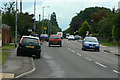
Watnall Road
The B6009 from Hucknall towards Watnall and Eastwood
Image: © Alan Murray-Rust
Taken: 7 Jun 2010
0.12 miles
2

Former access road at Watnall airfield
The area has been converted to industrial use many years ago.
Image: © Alan Murray-Rust
Taken: 30 Jul 2025
0.13 miles
3

Former hangars at Watnall airfield - 2
Side wall of hangars 1 and 2 of a group of four at the former Watnall Airfield. They were constructed in 1916 during World War 1 and are fine examples of the use of timber Belfast trusses (not visible!) to span a wide area suitable for storing aircraft. For many years now in use as a transport storage depot. Listed Grade II.
Image: © Alan Murray-Rust
Taken: 30 Jul 2025
0.14 miles
4

Former hangars at Watnall airfield - 3
Side wall of hangars 1 and 2 of a group of four at the former Watnall Airfield. They were constructed in 1916 during World War 1 and are fine examples of the use of timber Belfast trusses (not visible!) to span a wide area suitable for storing aircraft. For many years now in use as a transport storage depot. Listed Grade II.
Image: © Alan Murray-Rust
Taken: 30 Jul 2025
0.14 miles
5

Former hangars at Watnall airfield - 1
West façade of hangars 1 and 2 of a group of four at the former Watnall Airfield. They were constructed in 1916 during World War 1 and are fine examples of the use of timber Belfast trusses (not visible!) to span a wide area suitable for storing aircraft. For many years now in use as a transport storage depot. Listed Grade II.
Image: © Alan Murray-Rust
Taken: 30 Jul 2025
0.16 miles
6
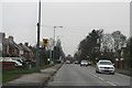
Watching you watching me: speed camera, B6009, Hucknall
Image: © Chris
Taken: 26 Dec 2014
0.16 miles
7
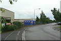
Daniels Way
Industrial development on the northern side of Hucknall Airfield.
Image: © Alan Murray-Rust
Taken: 7 Jun 2010
0.17 miles
8
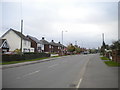
Watnall Road, Westville
The B6009 heading out of Hucknall.
Image: © Richard Vince
Taken: 28 Oct 2017
0.18 miles
9
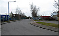
Daniels Way, Hucknall
Light Industrial Estate on the southern edge of the town.
Image: © David Lally
Taken: 14 Feb 2009
0.19 miles