
IMAGES TAKEN NEAR TO
Fox Meadow, NOTTINGHAM, NG15 6UZ
Introduction
This page details the photographs taken nearby to Fox Meadow, NG15 6UZ by members of the Geograph project.
The Geograph project started in 2005 with the aim of publishing, organising and preserving representative images for every square kilometre of Great Britain, Ireland and the Isle of Man.

There are currently over 7.5m images from over14,400 individuals and you can help contribute to the project by visiting https://www.geograph.org.uk
Image Map
Images are licensed for reuse under creativecommons.org/licenses/by-sa/2.0
Notes
- Clicking on the map will re-center to the selected point.
- The higher the marker number, the further away the image location is from the centre of the postcode.
Image Listing (20 Images Found)
Images are licensed for reuse under creativecommons.org/licenses/by-sa/2.0
Image
Details
Distance
2
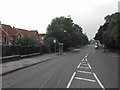
Bus Shelter on Watnall Road
in the Hazelgrove area of Hucknall
Image: © Tom Courtney
Taken: 5 Sep 2005
0.13 miles
3

Long Hill Rise, Hucknall
1930s housing development. The road name sign is particularly unusual.
Image: © Alan Murray-Rust
Taken: 21 Jul 2025
0.14 miles
4

Long Hill Rise postbox no. NG5 16, Hucknall
GVIR pillar box with attached and separate drop-boxes.
Image: © Alan Murray-Rust
Taken: 21 Jul 2025
0.16 miles
6

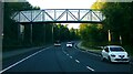
Old Railway alignment, Hucknall
This was the former Great Central Railway main line, originally running in a cutting which has been filled in.
Image: © Alan Murray-Rust
Taken: 21 Jul 2025
0.19 miles
7
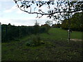
Course of the former Great Central Railway
Now an infilled cutting.
Image: © Jonathan Thacker
Taken: 5 Nov 2023
0.19 miles
8
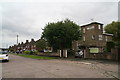
Long Hill Rise, Hucknall
Two unusual houses at the top of this cul-de-sac.
Image: © Chris
Taken: 26 Aug 2014
0.19 miles
9

Former railway bridge, Watnall Road, Hucknall
Crossing the former Great Central Railway, the bridge was to that company’s standard design at a station with an island platform. The twin raised copings often flanked the entrance to such stations, although in this case the station buildings were behind the camera https://www.geograph.org.uk/photo/8108049 .
There is a benchmark https://www.geograph.org.uk/photo/8108056 to the right of the right hand raised coping.
Image: © Alan Murray-Rust
Taken: 21 Jul 2025
0.19 miles
10

Watnall Road, Hucknall
Roundabout at Hucknall By-pass.
Image: © Alan Murray-Rust
Taken: 30 Jul 2025
0.20 miles