IMAGES TAKEN NEAR TO
Misk Hollows, NOTTINGHAM, NG15 6SW
Introduction
This page details the photographs taken nearby to Misk Hollows, NG15 6SW by members of the Geograph project.
The Geograph project started in 2005 with the aim of publishing, organising and preserving representative images for every square kilometre of Great Britain, Ireland and the Isle of Man.

There are currently over 7.5m images from over14,400 individuals and you can help contribute to the project by visiting https://www.geograph.org.uk
Image Map
Images are licensed for reuse under creativecommons.org/licenses/by-sa/2.0
Notes
- Clicking on the map will re-center to the selected point.
- The higher the marker number, the further away the image location is from the centre of the postcode.
Image Listing (11 Images Found)
Images are licensed for reuse under creativecommons.org/licenses/by-sa/2.0
Image
Details
Distance
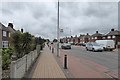
1
Greenwood Avenue
Looking from Coniston Road towards Washdyke Lane.
Image: © Alan Murray-Rust
Taken: 7 Jun 2010
0.17 miles
2
Washdyke Lane, passing Dobpark
Looking towards the A611 Hucknall bypass.
Image: © Richard Vince
Taken: 21 Nov 2015
0.18 miles
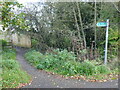
3
Entrance to Dobpark nature reserve from Washdyke Lane
Image: © Richard Vince
Taken: 21 Nov 2015
0.18 miles
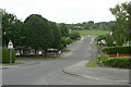
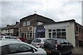
4
Annesley Road
Looking north away from Hucknall
Image: © David Lally
Taken: 27 Apr 2017
0.18 miles
5
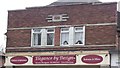
Art Deco detail
On an Annesley Road shop front. From around 1938 I'd say.
Image: © David Lally
Taken: 27 Apr 2017
0.18 miles
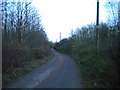
6
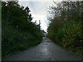
Washdyke Lane near Hucknall
Leads to a couple of cottages and New Farm.
Image: © Jonathan Thacker
Taken: 5 Nov 2023
0.18 miles
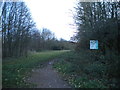
8
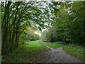
Path in Dob Park
Dob Park is a community woodland.
Image: © Jonathan Thacker
Taken: 5 Nov 2023
0.19 miles
9
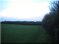
Field north of Dobpark
A public footpath is just perceptible on the right.
Image: © Richard Vince
Taken: 21 Nov 2015
0.20 miles