
IMAGES TAKEN NEAR TO
Annesley Cutting, NOTTINGHAM, NG15 0EN
Introduction
This page details the photographs taken nearby to Annesley Cutting, NG15 0EN by members of the Geograph project.
The Geograph project started in 2005 with the aim of publishing, organising and preserving representative images for every square kilometre of Great Britain, Ireland and the Isle of Man.

There are currently over 7.5m images from over14,400 individuals and you can help contribute to the project by visiting https://www.geograph.org.uk
Image Map
Images are licensed for reuse under creativecommons.org/licenses/by-sa/2.0
Notes
- Clicking on the map will re-center to the selected point.
- The higher the marker number, the further away the image location is from the centre of the postcode.
Image Listing (4 Images Found)
Images are licensed for reuse under creativecommons.org/licenses/by-sa/2.0
Image
Details
Distance
1
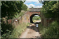
Railway bridge near Annesley
On top of the bridge is the reopened Robin Hood Line. Underneath is the former route of the Leen Valley Line which serviced Annesley Colliery.
Image: © Bill Boaden
Taken: 2 Jul 2022
0.14 miles

3
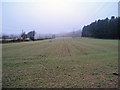
Reclaimed railway cutting near Annesley
Looking north-west along the line of pylons to Robin Hood's Hills. Today a quiet patch of arable land, but once this was a main line railway. Between the 1890s and 1960s, the Great Central Railway ran along here and entered Kirkby Tunnel just ahead...
https://www.railwayarchive.org.uk/getobject?rnum=L2775
This land was the rock cutting south of the tunnel and a few hundred yards behind was Hollingwell Station. Kirkby Tunnel and the cutting have been filled in and there is no sign of the station, which closed in the 1940s, except that the refreshment hut at the 9th of the nearby Notts Golf Club is still called the Hollingwell Halt. This also explains the curious shape of the public footpath route, which would have originally run along each side of the cutting. A good example of how a landscape can change over time.
Image: © Trevor Rickard
Taken: 6 Feb 2010
0.22 miles
4
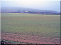
The Robin Hood Line
Looking east to a train on the embankment of the Robin Hood Line, which runs north of Nottingham along the former Midland Railway main line. In the mist at the back are Robin Hood's Hills.
The Nottingham-Mansfield-Worksop passenger service was withdrawn in October 1964, closing this route which had existed for 115 years and leaving Mansfield as the largest town in Britain without a railway station. The track remained since it was required for coal traffic but goods yards were relentlessly closed along with some of the older collieries. The Annesley Tunnel and its approach cuttings were gradually filled with spoil and refuse.
European money for the project looked promising and in July 1990 an Act for the Newstead-Kirkby link was acquired by British Rail. The name 'Robin Hood Line' was adopted and a consortium of local authorities gave the final go-ahead a year later.
http://www.wagonplate9.co.uk/The%20Robin%20Hood%20Line/Robin%20Hood%20Line%20Web%20Pages/Construction.htm
http://www.wagonplate9.co.uk/The%20Robin%20Hood%20Line/Robin%20Hood%20Line%20Web%20Pages/Stage%202.htm
Image: © Trevor Rickard
Taken: 6 Feb 2010
0.25 miles