IMAGES TAKEN NEAR TO
Cottage Pasture Lane, NOTTINGHAM, NG14 7EQ
Introduction
This page details the photographs taken nearby to Cottage Pasture Lane, NG14 7EQ by members of the Geograph project.
The Geograph project started in 2005 with the aim of publishing, organising and preserving representative images for every square kilometre of Great Britain, Ireland and the Isle of Man.

There are currently over 7.5m images from over14,400 individuals and you can help contribute to the project by visiting https://www.geograph.org.uk
Image Map
Images are licensed for reuse under creativecommons.org/licenses/by-sa/2.0
Notes
- Clicking on the map will re-center to the selected point.
- The higher the marker number, the further away the image location is from the centre of the postcode.
Image Listing (13 Images Found)
Images are licensed for reuse under creativecommons.org/licenses/by-sa/2.0
Image
Details
Distance
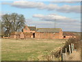
1
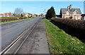
Marlock Cottages along the A6097 Lowdham Road
Image: © Mat Fascione
Taken: 25 Mar 2016
0.07 miles
2
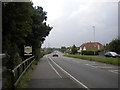
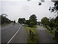
A6097 with premature sign, Lowdham
I would say that the Gunthorpe sign (left) on the way out of Lowdham is about half a mile too soon. Perhaps it refers to the parish rather than the village.
Image: © Richard Vince
Taken: 24 Aug 2013
0.09 miles
3
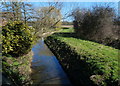
Cocker Beck at Marlock Bridge, Lowdham
Cocker Beck is a small tributary of the River Trent, which it joins near Gunthorpe.
Image: © Mat Fascione
Taken: 25 Mar 2016
0.14 miles
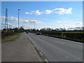
5
Bypass and old road, Lowdham
The footpath on the right follows the course of Gunthorpe Road as it headed into Lowdham before the construction of the bypass (left), which enables the A6097 to avoid Lowdham village (including the level crossing at the railway station).
Image: © Richard Vince
Taken: 24 Aug 2013
0.17 miles
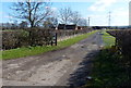
8
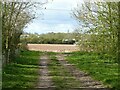
Farm track and field. Lowdham
Part of the local group of permissive footpaths.
Image: © Alan Murray-Rust
Taken: 6 Apr 2021
0.20 miles
9
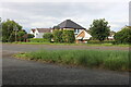
Lowdham Road
The house in the middle was built in the last two years.
Image: © David Howard
Taken: 16 Jul 2023
0.21 miles
10
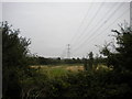
Farmland and pylons near Lowdham (2)
Image: © Richard Vince
Taken: 24 Aug 2013
0.23 miles