1
Former framework knitters' workshops, Lowdham
One of a pair of buildings on the corner of Ton Lane and Main Street, now occupied by a soft furnishings firm. Early 19th century, Listed Grade II.
Image: © Alan Murray-Rust
Taken: 13 Jun 2020
0.02 miles
2
Former framework knitters' workshops, Lowdham
One of a pair of buildings on the corner of Ton Lane and Main Street, now occupied by a soft furnishings firm. Early 19th century, Listed Grade II.
Image: © Alan Murray-Rust
Taken: 13 Jun 2020
0.03 miles
3
Retail conversion
This range of buildings has been converted into 3 or 4 specialist retail outlets. The nearest one deals in soft furnishings.
Image: © Alan Murray-Rust
Taken: 17 Oct 2008
0.03 miles
4
Ton Lane
The exit from the village towards the Church and then Lambley. Note the new houses at the left which incorporate some vernacular style of brickwork.
Image: © Alan Murray-Rust
Taken: 17 Oct 2008
0.03 miles
5
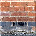
Bench mark, 67 Main Street, Lowdham
See http://www.geograph.org.uk/photo/6509414 for location.
Image: © Alan Murray-Rust
Taken: 13 Jun 2020
0.03 miles
6
Holly Tree Cottage and no.67 Main Street, Lowdham
There is a benchmark http://www.geograph.org.uk/photo/6509416 on no.67 under the nearer white window.
Image: © Alan Murray-Rust
Taken: 13 Jun 2020
0.03 miles
7
Lowdham, Notts.
With solar panels in place, this is the former primary school in Main Street that was in use until 1988. Part of the building is now a private residence, whilst another part of it houses the village library. The clock was paid for by public subscription and installed to commemorate George V's coronation. The house on the right was the previously the head teacher's house but it is now privately owned. Although this picture gives the impression that these two buildings are joined, they are in fact separated by a path.
Image: © David Hallam-Jones
Taken: 28 Feb 2014
0.04 miles
8
Lowdham Main Street
Lowdham Village stores and Main Street
Image: © Joy Newbould
Taken: 26 Aug 2013
0.04 miles
9
Lowdham, Notts.
A thriving independent bookshop has occupied the ground floor of this red-brick building on Main Street for a number of years. The property's earlier career included being two houses and its history has also included hosting a bakery & baker's shop and a butcher's shop & premises, at different times; the 'messy work' perhaps being carried out in the extension at the rear? The upper floor currently houses a tea shop. The road ahead leads out of this 'half' of the village towards the main Nottingham-Southwell road. The railway station is also on the other side of the A619 road, 5 minutes away.
Image: © David Hallam-Jones
Taken: 28 Feb 2014
0.04 miles
10
The Old School House
The school was moved to a modern building some time ago and the old premises converted to dwellings. Nice to see a working external clock on a private building.
Image: © Alan Murray-Rust
Taken: 17 Oct 2008
0.05 miles


