1
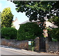
203 and 205 Main Street
The extension is a sympathetic attempt at matching the traditional building style, doubtless resulting from the fact that this is within the Conservation Area of the village. Nevertheless, the roof pitch is much flatter than ideal, and the plastic windows appear to have an angular top rather than a true curve.
Image: © Alan Murray-Rust
Taken: 14 Aug 2011
0.02 miles
2
No.152
An unusual way of displaying one's house number.
Image: © Alan Murray-Rust
Taken: 14 Aug 2011
0.03 miles
3
215 and 221 Main Street
The non-consecutive numbering is due to the fact that what was once a group of cottages is now converted into two dwellings. This would originally have been a group of four cottages, built as the large windows indicate for framework knitters. The end gable displays the letters MS and 1857. The letters are the initials of Matthew Shepherd, who was headmaster of the Labray Endowed School. http://www.geograph.org.uk/photo/2559117 Listed Grade II.
Image: © Alan Murray-Rust
Taken: 14 Aug 2011
0.04 miles
4
130 Main Street
A small hosiery factory, which would have been equipped with framework knitting machines, a bit of an exception when most of the work was done in private dwellings. Built c1830, with the nearer end possibly slightly later. Listed Grade II. In use as a hosiery factory until 1944, later a printing works, currently a curtains and blinds supplier.
Image: © Alan Murray-Rust
Taken: 14 Aug 2011
0.05 miles
5
George's Lane, Calverton
From Main Street
Image: © David Howard
Taken: 16 Jul 2023
0.06 miles
6
Pinfold, Calverton, Notts.
A former C17th pinfold (a.k.a. stray animal pen) at the junction of Main Street and Mews Lane. The white gate marks the entrance into the village hall car park. The house beyond the pinfold, with the generous windows that allowed in as much natural light as possible, was a former frame-knitter's (stocking knitter's) house. By the early 1800s there were said to be more than 400 stocking frames in homes in Calverton. Some cottagers had four or five frames in one room. The heart of the village, with its churches, library and shops, lies behind the photographer.
Image: © David Hallam-Jones
Taken: 1 Oct 2015
0.06 miles
7
Mews Lane, Calverton postbox (ref. NG14 26)
G VI R pillar box on Main Street. Also its neighbouring cast iron fingerpost, currently in need of some fresh paint.
Image: © Alan Murray-Rust
Taken: 14 Aug 2011
0.06 miles
8
Calverton NG14, Notts.
At this junction with George Street the village pinfold on Main Street is quite obvious and beyond it, a former frame-knitting establishment, i.e. cottage and workshop/s with the characteristically large windows. Behind the pillar-box at the junction with Mews Lane is the former village hall. This was sold in 2009/10 to raise monies for a new community centre.
Image: © David Hallam-Jones
Taken: 26 May 2013
0.06 miles
9
Labray's School, Calverton, Notts.
The former Labray's Endowed School, Main Street, is situated obliquely opposite Little Lane. Jonathan Labray, a Nottingham stocking-frame knitter during the C17th, never forgot his humble origins and made provision in his will for some of his money to be used for the benefit of poor local boys. He had a special connection with Calverton, having owned land and property in the village and, as a result, in 1718 his trustees decided to set aside £10 p.a. from his estate to employ a schoolmaster to teach the village's boys, without charge. The Labray School continued to educate village children for 255 years until its closure in 1973. The refurbished premises are now used by Scouts and Guides.
Image: © David Hallam-Jones
Taken: 1 Oct 2015
0.07 miles
10
Main Street, Calverton
Image: © David Howard
Taken: 16 Jul 2023
0.07 miles


