IMAGES TAKEN NEAR TO
Church Road, NOTTINGHAM, NG14 5GE
Introduction
This page details the photographs taken nearby to Church Road, NG14 5GE by members of the Geograph project.
The Geograph project started in 2005 with the aim of publishing, organising and preserving representative images for every square kilometre of Great Britain, Ireland and the Isle of Man.

There are currently over 7.5m images from over14,400 individuals and you can help contribute to the project by visiting https://www.geograph.org.uk
Image Map
Images are licensed for reuse under creativecommons.org/licenses/by-sa/2.0
Notes
- Clicking on the map will re-center to the selected point.
- The higher the marker number, the further away the image location is from the centre of the postcode.
Image Listing (40 Images Found)
Images are licensed for reuse under creativecommons.org/licenses/by-sa/2.0
Image
Details
Distance
1
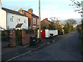
Gordon Road
Part of a late Victorian development at the east end of Burton Joyce. The reason for this development is unclear as the housing between it and the old centre of the village is substantially newer. At the same time, it is not particularly close to the railway station which brings into question whether it was intended for Nottingham commuters.
Image: © Alan Murray-Rust
Taken: 14 Nov 2008
0.06 miles
2
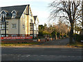
Shaftesbury Avenue
The apartments to the left have been built on land that clearly formerly belonged to the Nottingham Corporation Waterworks. This can be seen from the fact that the brick wall with its decorative gateposts is continuous with the part of the site still in use for pumping. (compare Image)
Image: © Alan Murray-Rust
Taken: 14 Nov 2008
0.06 miles
4
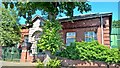
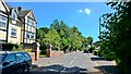
Nottingham Corporation Waterworks
Pumping station dating back to 1928, now operated by Severn Trent
Image: © Chris Morgan
Taken: 19 Jul 2016
0.07 miles
5
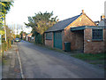
Gordon Road
Part of a late Victorian development at the east end of Burton Joyce. The reason for this development is unclear as the housing between it and the old centre of the village is substantially newer. At the same time, it is not particularly close to the railway station which brings into question whether it was intended for Nottingham commuters. The road only has one frontage, as the houses to the right front onto the neighbouring Wellington Road.
Image: © Alan Murray-Rust
Taken: 14 Nov 2008
0.07 miles
7
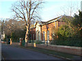
Waterworks, Shaftesbury Avenue
Burton Joyce was the first station to pump water from boreholes to Nottingham. The first was sunk in 1898 with a further three, 480 ft deep, in 1908. This building dates from 1928 when electric pumps were built to replace steam engines.
Image: © Alan Murray-Rust
Taken: 14 Nov 2008
0.07 miles
8
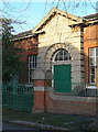
Waterworks, Shaftesbury Avenue
The main entrance to the pump house built in 1928 to house the new electric pumps replacing the former steam driven pumps.
Image: © Alan Murray-Rust
Taken: 14 Nov 2008
0.07 miles
9
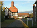
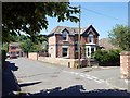
Manager's house
This would have been the dwelling for the manager of the waterworks. These were built by the Nottingham Corporation Waterworks in 1898 and are now operated by Severn Trent Water.
Image: © Alan Murray-Rust
Taken: 14 Nov 2008
0.07 miles