IMAGES TAKEN NEAR TO
Wharf Gardens, NOTTINGHAM, NG13 8YE
Introduction
This page details the photographs taken nearby to Wharf Gardens, NG13 8YE by members of the Geograph project.
The Geograph project started in 2005 with the aim of publishing, organising and preserving representative images for every square kilometre of Great Britain, Ireland and the Isle of Man.

There are currently over 7.5m images from over14,400 individuals and you can help contribute to the project by visiting https://www.geograph.org.uk
Image Map
Images are licensed for reuse under creativecommons.org/licenses/by-sa/2.0
Notes
- Clicking on the map will re-center to the selected point.
- The higher the marker number, the further away the image location is from the centre of the postcode.
Image Listing (20 Images Found)
Images are licensed for reuse under creativecommons.org/licenses/by-sa/2.0
Image
Details
Distance
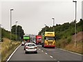
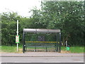
2
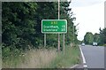
A52 Bingham Bypass
From the lay-by looking east. The sign reads "Grantham 15 Stamford 35".
Image: © Trevor Rickard
Taken: 1 May 2010
0.09 miles
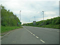
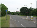
5
Route confirmation sign on the A52 Bingham Bypass
Image: © David Howard
Taken: 16 Jul 2023
0.15 miles
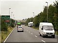
6
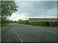
Nottingham Road
Main road heading west out of Bingham. A maze of modern housing estates on both sides.
Image: © Trevor Rickard
Taken: 1 May 2010
0.15 miles
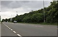
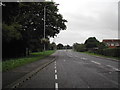
10
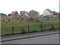
Lune Way
The former agricultural land between Mallow Way and the A52 is gradually being infilled with housing as the final stage of development of this part of Bingham.
Image: © Alan Murray-Rust
Taken: 2 Sep 2011
0.18 miles