
IMAGES TAKEN NEAR TO
Holloway Close, NOTTINGHAM, NG13 8NG
Introduction
This page details the photographs taken nearby to Holloway Close, NG13 8NG by members of the Geograph project.
The Geograph project started in 2005 with the aim of publishing, organising and preserving representative images for every square kilometre of Great Britain, Ireland and the Isle of Man.

There are currently over 7.5m images from over14,400 individuals and you can help contribute to the project by visiting https://www.geograph.org.uk
Image Map
Images are licensed for reuse under creativecommons.org/licenses/by-sa/2.0
Notes
- Clicking on the map will re-center to the selected point.
- The higher the marker number, the further away the image location is from the centre of the postcode.
Image Listing (14 Images Found)
Images are licensed for reuse under creativecommons.org/licenses/by-sa/2.0
Image
Details
Distance
1
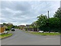
Crossways Drive in East Bridgford
Pictured from its junction with Cross Lane.
Image: © Jonathan Clitheroe
Taken: 13 Jul 2024
0.08 miles
2
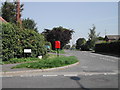
East Bridgford Village
junction of Cross Lane and Main Street
Image: © Tom Courtney
Taken: 31 Aug 2005
0.18 miles
3
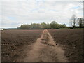
Footpath and Springdale Wood
Springdale Wood is a small Woodland Trust plantation.
Image: © Jonathan Thacker
Taken: 16 Apr 2021
0.20 miles
4
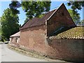
Outbuildings at Mulberry Close
Largely early 19th century. The taller section here was originally stables with hayloft over. Listed Grade II.
Image: © Alan Murray-Rust
Taken: 29 May 2020
0.20 miles
5
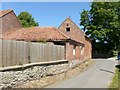
Outbuildings at Mulberry Close
Largely early 19th century. The taller section here was originally stables with hayloft over. Listed Grade II.
Image: © Alan Murray-Rust
Taken: 29 May 2020
0.20 miles
6
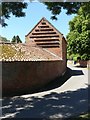
Outbuildings at Mulberry Close
Largely early 19th century. The taller section here was originally a dovecote, the curved section originally cowsheds. Listed Grade II.
Image: © Alan Murray-Rust
Taken: 29 May 2020
0.21 miles
7
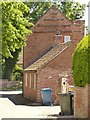
Outbuildings at Mulberry Close
Largely early 19th century. The taller section here was originally a dovecote. Listed Grade II.
Image: © Alan Murray-Rust
Taken: 29 May 2020
0.21 miles
8
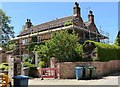
Mulberry Close, East Bridgford
Early 19th century farmhouse (built 1820), under refurbishment in 2020. Listed Grade II.
Image: © Alan Murray-Rust
Taken: 29 May 2020
0.22 miles
9
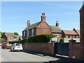
24 College Street, East Bridgford
Early 19th century (dated 1826) former farmhouse and stable block. Listed Grade II.
Image: © Alan Murray-Rust
Taken: 29 May 2020
0.22 miles
10
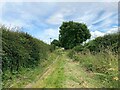
Closes Side Lane near East Bridgford
Bridleway which shows signs of having being paved in the past.
Image: © Jonathan Clitheroe
Taken: 13 Jul 2024
0.22 miles