
IMAGES TAKEN NEAR TO
Wilmot Close, NOTTINGHAM, NG13 8JF
Introduction
This page details the photographs taken nearby to Wilmot Close, NG13 8JF by members of the Geograph project.
The Geograph project started in 2005 with the aim of publishing, organising and preserving representative images for every square kilometre of Great Britain, Ireland and the Isle of Man.

There are currently over 7.5m images from over14,400 individuals and you can help contribute to the project by visiting https://www.geograph.org.uk
Image Map
Images are licensed for reuse under creativecommons.org/licenses/by-sa/2.0
Notes
- Clicking on the map will re-center to the selected point.
- The higher the marker number, the further away the image location is from the centre of the postcode.
Image Listing (81 Images Found)
Images are licensed for reuse under creativecommons.org/licenses/by-sa/2.0
Image
Details
Distance
1
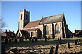
St.Mary's church
Splendid 14th century chancel, higher than the nave
Image: © Richard Croft
Taken: 3 Dec 2008
0.02 miles
2
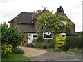
A living house number
The number for 5 Screveton Lane, Car Colston, is shown in this unusual topiary.
Image: © Richard Green
Taken: 28 Aug 2012
0.03 miles
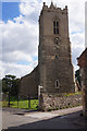
4
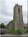
Church of St Mary, Car Colston
The lower part of the tower is 13th century, the bell chamber stage being late 15th century in Perpendicular style. The fine ashlar contrasts with the coursed rubble of the earlier period. Listed Grade I.
There is a bench mark http://www.geograph.org.uk/photo/3922177 on the nearest buttress.
Image: © Alan Murray-Rust
Taken: 6 Apr 2014
0.03 miles
5
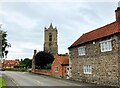
Tower of St Mary's Church in Car Colston
Church and surrounding cottages in the centre of the village.
Image: © Jonathan Clitheroe
Taken: 13 Jul 2024
0.03 miles
6
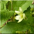
White Bryony (Bryonia dioica), Car Colston
Alongside Screveton Road. See also https://www.geograph.org.uk/photo/6502803
Image: © Alan Murray-Rust
Taken: 7 Jun 2020
0.03 miles
7
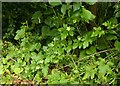
White Bryony (Bryonia dioica), Car Colston
Alongside Screveton Road. See https://www.geograph.org.uk/photo/6502805 for close-up
Image: © Alan Murray-Rust
Taken: 7 Jun 2020
0.03 miles
8
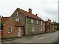
Martin's Cottage, Car Colston
Late 18th century house, in stone rubble, the only stone-built house in the village. Listed Grade II.
Image: © Alan Murray-Rust
Taken: 7 Jun 2020
0.03 miles
9
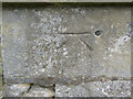
Bench mark with bolt, Car Colston Church
Used as a side level during the first primary levelling, England & Wales, 1840-60, see http://www.bench-marks.org.uk/bm22997 See http://www.geograph.org.uk/photo/3922181 for location.
Image: © Alan Murray-Rust
Taken: 6 Apr 2014
0.03 miles
10
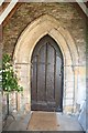
South doorway
14th century south doorway to St.Mary's church
Image: © Richard Croft
Taken: 3 Dec 2008
0.03 miles