
IMAGES TAKEN NEAR TO
Langar Road, NOTTINGHAM, NG13 8EY
Introduction
This page details the photographs taken nearby to Langar Road, NG13 8EY by members of the Geograph project.
The Geograph project started in 2005 with the aim of publishing, organising and preserving representative images for every square kilometre of Great Britain, Ireland and the Isle of Man.

There are currently over 7.5m images from over14,400 individuals and you can help contribute to the project by visiting https://www.geograph.org.uk
Image Map
Images are licensed for reuse under creativecommons.org/licenses/by-sa/2.0
Notes
- Clicking on the map will re-center to the selected point.
- The higher the marker number, the further away the image location is from the centre of the postcode.
Image Listing (12 Images Found)
Images are licensed for reuse under creativecommons.org/licenses/by-sa/2.0
Image
Details
Distance
1
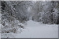
Bingham Linear Walk in Snow
Taken looking down the Linear Walk from the old Railway Bridge, February 2009
Image: © Neil Baker
Taken: 5 Feb 2009
0.07 miles
2
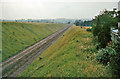
Site of Bingham Road Station
View NW, towards Saxondale Junction and Nottingham; trackbed of former GN&LNW line from Harby & Stathern, Melton Mowbray and Market Harborough. The station was sited at the far end of the cutting. Station closed 2/7/51, line closed to passengers 7/12/53, to goods 10/9/62.
Image: © Ben Brooksbank
Taken: 13 Jul 1963
0.07 miles
3
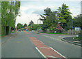
Tithby Road
Heading north to the centre of Bingham. On the right is The Banks, leading to Bingham Leisure Centre.
Image: © Trevor Rickard
Taken: 1 May 2010
0.13 miles
4
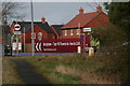
Bingham is heaven: selling new houses in Bingham
Image: © Chris
Taken: 12 Feb 2014
0.21 miles
6
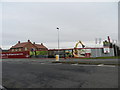
New build, south of Bingham
More houses under construction in a town "one of the top 10 towns to live in UK"
Image: © Peter Barr
Taken: 7 Feb 2013
0.22 miles
7
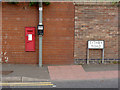
West End postbox (ref. NG13 98) - Bingham
VR B-size wallbox at the main Nottingham Road/Tithby Road/Long Acre/Station Road crossroads.
Image: © Alan Murray-Rust
Taken: 14 Sep 2012
0.22 miles
8
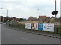
Mill Hill Road
The former agricultural land between Mill Hill Road and the A52 is gradually being infilled with housing as the final stage of development of this part of Bingham.
Image: © Alan Murray-Rust
Taken: 2 Sep 2011
0.23 miles
9
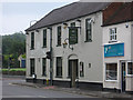
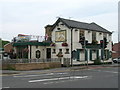
Bingham - The White Lion
On Fairfield Street. For an alternative view, please see Image
Image: © Dave Bevis
Taken: 21 Jun 2013
0.23 miles
10
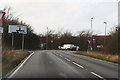
Arriving at the A52 Grantham Road south of Bingham
Image: © Chris
Taken: 12 Feb 2014
0.24 miles