
IMAGES TAKEN NEAR TO
Drift Hill, NOTTINGHAM, NG13 0GH
Introduction
This page details the photographs taken nearby to Drift Hill, NG13 0GH by members of the Geograph project.
The Geograph project started in 2005 with the aim of publishing, organising and preserving representative images for every square kilometre of Great Britain, Ireland and the Isle of Man.

There are currently over 7.5m images from over14,400 individuals and you can help contribute to the project by visiting https://www.geograph.org.uk
Image Map
Images are licensed for reuse under creativecommons.org/licenses/by-sa/2.0
Notes
- Clicking on the map will re-center to the selected point.
- The higher the marker number, the further away the image location is from the centre of the postcode.
Image Listing (101 Images Found)
Images are licensed for reuse under creativecommons.org/licenses/by-sa/2.0
Image
Details
Distance
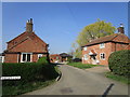
2
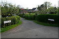
A circular walk from Redmile, (68)
Bakers Lane in Redmile leads from Main Street to Easthorpe Lane. This view looks down towards Main Street.
To follow this walk of about 6 miles along the canal and public footpaths, park in the village of Redmile somewhere near the Peacock Inn and walk north west out of the village to the bridge where you can gain access to the tow path. Photographs taken along the length of the walk are collected here: http://www.geograph.org.uk/search.php?i=2770823
Image: © Kate Jewell
Taken: 5 May 2008
0.04 miles
3
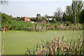
A circular walk from Redmile, (3)
The north edge of Redmile from the Grantham Canal. The canal widens into a small basin here. Although it looks solid it is in fact covered by a layer of delicate duckweed, an invasive aquatic plant. It has tiny rounded leaves each with a single root. It frequently forms green mats over the surface of water and does indeed provide food for ducks! See http://www.floralimages.co.uk/plemnaminor.htm
To follow this walk of about 6 miles along the canal and public footpaths, park in the village of Redmile somewhere near the Peacock Inn and walk north west out of the village to the bridge where you can gain access to the tow path. Photographs taken along the length of the walk are collected here: http://www.geograph.org.uk/search.php?i=2770823
Image: © Kate Jewell
Taken: 5 May 2008
0.04 miles
4
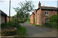
A circular walk from Redmile, (69)
Looking up Baker Lane in Redmile. The street at the top of the hill is Easthorpe Lane.
Well done, you have reached the end of the walk!
To follow this walk of about 6 miles along the canal and public footpaths, park in the village of Redmile somewhere near the Peacock Inn and walk north west out of the village to the bridge where you can gain access to the tow path. Photographs taken along the length of the walk are collected here: http://www.geograph.org.uk/search.php?i=2770823
Image: © Kate Jewell
Taken: 5 May 2008
0.05 miles
5
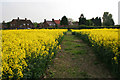
A circular walk from Redmile, (66)
Just over a mile and a half from Muston Gorse through never ending oilseed rape and we're back at the village of Redmil. The houses are on Easthorpe Lane.
To follow this walk of about 6 miles along the canal and public footpaths, park in the village of Redmile somewhere near the Peacock Inn and walk north west out of the village to the bridge where you can gain access to the tow path. Photographs taken along the length of the walk are collected here: http://www.geograph.org.uk/search.php?i=2770823
Image: © Kate Jewell
Taken: 5 May 2008
0.05 miles
6
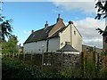
Old Rectory Cottage and the Old Rectory
The cottage is the slightly lower extension on this end of the building, built in the mid 18th century onto the existing late 17th century Rectory. Both are Listed grade II as separate entities.
Image: © Alan Murray-Rust
Taken: 23 Oct 2016
0.06 miles
7
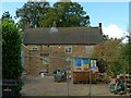
The Old Rectory, Redmile
The main frontage facing Baker's lane. The house, dating from the late 17th century, is clearly undergoing some refurbishment. Listed grade II.
Image: © Alan Murray-Rust
Taken: 23 Oct 2016
0.06 miles
8
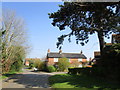
Post Office Lane, Redmile
Black pantiles are an occasionally found feature locally.
Image: © Jonathan Thacker
Taken: 30 Mar 2019
0.06 miles
9
Footpath to the church, Redmile
Runs from Bakers Lane.
Image: © Jonathan Thacker
Taken: 30 Mar 2019
0.06 miles
10
Easthorpe Lane, Redmile
A typical group of post-war council houses on the edge of the village.
Image: © Alan Murray-Rust
Taken: 23 Oct 2016
0.07 miles