
IMAGES TAKEN NEAR TO
Murdon Crescent, NG12 5SN
Introduction
This page details the photographs taken nearby to Murdon Crescent, NG12 5SN by members of the Geograph project.
The Geograph project started in 2005 with the aim of publishing, organising and preserving representative images for every square kilometre of Great Britain, Ireland and the Isle of Man.

There are currently over 7.5m images from over14,400 individuals and you can help contribute to the project by visiting https://www.geograph.org.uk
Image Map
Images are licensed for reuse under creativecommons.org/licenses/by-sa/2.0
Notes
- Clicking on the map will re-center to the selected point.
- The higher the marker number, the further away the image location is from the centre of the postcode.
Image Listing (45 Images Found)
Images are licensed for reuse under creativecommons.org/licenses/by-sa/2.0
Image
Details
Distance
1
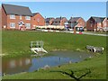
Keyworth Rise housing development
With the now obligatory attenuation pond for surface run-off in the foreground.
Image: © Alan Murray-Rust
Taken: 14 Mar 2022
0.03 miles
2
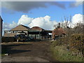
Greenhays Farm
Looking into the farmyard from Bunny Lane. This is one of three farms along Bunny Lane which are still functioning as such.
Image: © Alan Murray-Rust
Taken: 1 Nov 2011
0.03 miles
3
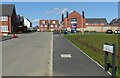
Tyler Drive, Keyworth
The main access into the new Keyworth Rise housing development.
Image: © Alan Murray-Rust
Taken: 14 Mar 2022
0.03 miles
4

Greenhays Farm
The farmhouse facing onto Bunny Lane.
Image: © Alan Murray-Rust
Taken: 1 Nov 2011
0.04 miles
5
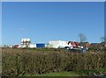
Contractor's compound, Keyworth
Part of the substantial housing development under the name 'Keyworth Rise' on the western end of the village. The planning application refers to 221 dwellings.
Image: © Alan Murray-Rust
Taken: 14 Mar 2022
0.05 miles
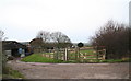
8

Entrance to Keyworth village
Village entrance sign on the road from Bunny.
Image: © Alan Murray-Rust
Taken: 1 Nov 2011
0.06 miles
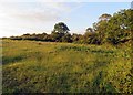
9

Hillside Farm
Seen from the footpath from Bunny, to the west of Keyworth Sewage Works.
Image: © Alan Murray-Rust
Taken: 1 Nov 2011
0.08 miles
10
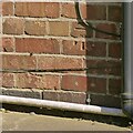
Bench Mark, 64 Bunny Lane, Keyworth
See https://www.geograph.org.uk/photo/7119737 for location.
Image: © Alan Murray-Rust
Taken: 14 Mar 2022
0.09 miles