1
Edwalton: the road to Lodge Farm
Houses are to be built on this land.
Image: © John Sutton
Taken: 2 May 2016
0.15 miles
2
Edwalton: Midland Railway bridge parapets
The Midland main line between Nottingham and Melton closed in the 1960s. This bridge, carrying Machins Lane to Lodge Farm (ahead), has been filled in. The railway's course from here to Melton Road in West Bridgford is now a footpath and nature reserve, The Green Line.
Image: © John Sutton
Taken: 2 May 2016
0.15 miles
3
Edwalton: once a railway bridge
The Midland main line between Nottingham and Melton closed in the 1960s. This bridge, carrying Machins Lane to Lodge Farm (behind the camera), has been filled in. The railway's course from here to Melton Road in West Bridgford is now a footpath and nature reserve, The Green Line.
Image: © John Sutton
Taken: 2 May 2016
0.15 miles
4
Melton Road, Edwalton
Many of the houses along this road are gated and hidden by trees and hedges.
Image: © David Howard
Taken: 8 May 2022
0.15 miles
5
Edwalton: fields on the southern edge of Nottingham
Sharphill Wood is on the skyline.
Image: © John Sutton
Taken: 2 May 2016
0.17 miles
6
Melton Road near Edwalton
Still a busy road, although through traffic is now routed via Lings Bar Road.
Image: © Alan Murray-Rust
Taken: 23 Sep 2008
0.20 miles
7
Former trackbed of the railway between Nottingham and Melton
Image: © Tim Glover
Taken: 31 May 2009
0.21 miles
8
Footpath at Edwalton
Recreating this 'First' for the square https://www.geograph.org.uk/photo/229031
Image: © Alan Murray-Rust
Taken: 23 Jan 2022
0.23 miles
9
Footpath at Edwalton
The land on both sides of the footpath dips down as it crosses a former railway line. The gate at the end leads to Edwalton Golf Course.
Image: © Catherine Davis
Taken: 30 Aug 2006
0.24 miles
10
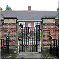
Edwalton: the gate of the Hind Almshouses
These almshouses were built in 1927 by Oliver Hind of Edwalton Hall, in memory of his parents and of his brother and a nephew, both of whom were killed on The Somme.
Image: © John Sutton
Taken: 25 Sep 2013
0.24 miles


