IMAGES TAKEN NEAR TO
Firs Road, NOTTINGHAM, NG12 4BX
Introduction
This page details the photographs taken nearby to Firs Road, NG12 4BX by members of the Geograph project.
The Geograph project started in 2005 with the aim of publishing, organising and preserving representative images for every square kilometre of Great Britain, Ireland and the Isle of Man.

There are currently over 7.5m images from over14,400 individuals and you can help contribute to the project by visiting https://www.geograph.org.uk
Image Map
Images are licensed for reuse under creativecommons.org/licenses/by-sa/2.0
Notes
- Clicking on the map will re-center to the selected point.
- The higher the marker number, the further away the image location is from the centre of the postcode.
Image Listing (20 Images Found)
Images are licensed for reuse under creativecommons.org/licenses/by-sa/2.0
Image
Details
Distance
1
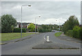
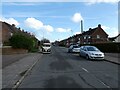
Melton Gardens
A distributor road which is much more recent than all the surrounding roads. It was not built until the development of the Gamston estate to the east, and provides a direct link from the main Melton Road.
Image: © Alan Murray-Rust
Taken: 23 Sep 2008
0.12 miles
2
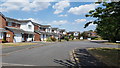
Melton Gardens, Edwalton
Houses on Melton Gardens in Edwalton.
Image: © Peter Mackenzie
Taken: 6 Jul 2018
0.15 miles
3
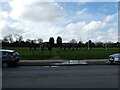
Rugby training on playing fields
Great to see youngsters benefitting from rugby training; tacking into crash pads, practicing actual tackling and generally absorbing the culture of respect, sportsmanship, physical strength, endurance, teamwork, communication and very subtle cheating that this sport enfuses it's players with.
Image: © Jeremy Bolwell
Taken: 25 Feb 2024
0.17 miles
4
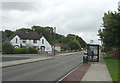
Alford Road
This is the main road into the Edwalton estate.
Image: © Alan Murray-Rust
Taken: 23 Sep 2008
0.20 miles
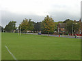
5
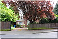
Part of Luttrell Way
Nice street in West Bridgford.
Image: © Jeremy Bolwell
Taken: 25 Feb 2024
0.20 miles
6
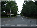
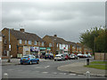
Alford Road at Spinney Close
Many of the roads on this council estate have these distinctive houses with their gable fronts at the junctions.
Image: © Alan Murray-Rust
Taken: 23 Sep 2008
0.22 miles
8
#28 Valley Road
There is an OS benchmark Image on the right hand side of an outbuilding partly hidden by trees to the left of wheelie bins
Image: © Roger Templeman
Taken: 12 May 2018
0.22 miles
9
Earlswood Drive
A small shopping parade developed as part of the council-developed estate.
Image: © Alan Murray-Rust
Taken: 23 Sep 2008
0.22 miles
10
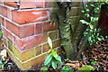
Benchmark on outbuilding at #28 Valley Road
Ordnance Survey cut mark benchmark described on the Bench Mark Database at https://www.bench-marks.org.uk/bm102410
Image: © Roger Templeman
Taken: 12 May 2018
0.22 miles