IMAGES TAKEN NEAR TO
Rectory Road, NOTTINGHAM, NG12 3HU
Introduction
This page details the photographs taken nearby to Rectory Road, NG12 3HU by members of the Geograph project.
The Geograph project started in 2005 with the aim of publishing, organising and preserving representative images for every square kilometre of Great Britain, Ireland and the Isle of Man.

There are currently over 7.5m images from over14,400 individuals and you can help contribute to the project by visiting https://www.geograph.org.uk
Image Map
Images are licensed for reuse under creativecommons.org/licenses/by-sa/2.0
Notes
- Clicking on the map will re-center to the selected point.
- The higher the marker number, the further away the image location is from the centre of the postcode.
Image Listing (67 Images Found)
Images are licensed for reuse under creativecommons.org/licenses/by-sa/2.0
Image
Details
Distance
1
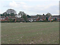
Houses at Cotgrave
1970s (-ish) development on the west edge of the village.
Image: © Alan Murray-Rust
Taken: 20 Oct 2011
0.02 miles
2
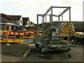
Woodgate Lane, Cotgrave
Gas pipe installation. The trailer is a carrier foe coiled plastic piping.
Image: © Alan Murray-Rust
Taken: 9 Jan 2022
0.08 miles
4
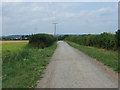
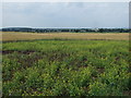
Woodgate Lane (track)
Towards Peashill Farm.
Image: © JThomas
Taken: 27 Jul 2013
0.10 miles
5
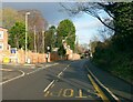
Baker's Hollow, Cotgrave
Recreating this 'First' for the square https://www.geograph.org.uk/photo/51975 .
The name refers to the short section of Plumtree Road which at some stage has been cut deeper to ease the gradient of the road. A new housing development, Baker's Close has been added on the left of the picture.
Image: © Alan Murray-Rust
Taken: 9 Jan 2022
0.10 miles
6
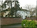
The Old Rectory, Cotgrave
Early 19th century house with modern extension at the far end. Listed Grade II.
Image: © Alan Murray-Rust
Taken: 9 Jan 2022
0.10 miles
7
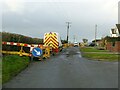
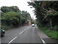
Woodgate Lane, Cotgrave
Unadopted road, classified as a public bridleway. The works were connected with a main gas pipe.
Image: © Alan Murray-Rust
Taken: 9 Jan 2022
0.10 miles
9
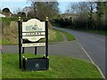
Cotgrave village entrance sign
On Plumtree Road, it shows the parish Church of All Saints. The new Cotgrave signs feature a variety of local landmarks.
Image: © Alan Murray-Rust
Taken: 9 Jan 2022
0.13 miles
10
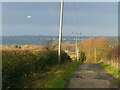
Woodgate Lane, Cotgrave
Public bridleway and access lane to farms and the local sewage treatment plant.
The light aircraft was performing a succession of circuits from nearby Tollerton airfield, clearly as part of pilot training.
Image: © Alan Murray-Rust
Taken: 9 Jan 2022
0.13 miles