IMAGES TAKEN NEAR TO
The Fosse, NOTTINGHAM, NG12 3HF
Introduction
This page details the photographs taken nearby to The Fosse, NG12 3HF by members of the Geograph project.
The Geograph project started in 2005 with the aim of publishing, organising and preserving representative images for every square kilometre of Great Britain, Ireland and the Isle of Man.

There are currently over 7.5m images from over14,400 individuals and you can help contribute to the project by visiting https://www.geograph.org.uk
Image Map
Images are licensed for reuse under creativecommons.org/licenses/by-sa/2.0
Notes
- Clicking on the map will re-center to the selected point.
- The higher the marker number, the further away the image location is from the centre of the postcode.
Image Listing (15 Images Found)
Images are licensed for reuse under creativecommons.org/licenses/by-sa/2.0
Image
Details
Distance
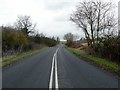
1
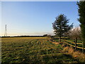
Grass field by the Fosse Way near Cotgrave
Image: © Jonathan Thacker
Taken: 6 Feb 2022
0.06 miles
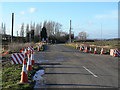
2
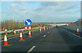
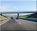
New section of the A46 near Cotgrave
Looking north at the point where the route slopes down off the Cropwell Wolds to provide a good view of the new road snaking ahead. Just ahead is a new bridge taking the Colston Gate road over the new carriageway. Dualling this 20-mile stretch of road between the A606 and Newark has meant roadworks for several years - I've duelled it a few times now and it always seems to win, so roll on 'late 2012'!
For more details on the roadworks see - Image
Image: © Trevor Rickard
Taken: 3 Dec 2011
0.06 miles
3
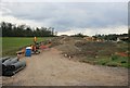
A46 roadworks
Near the junction of the A46 the countryside is being bulldozed to make way for road improvements on the A46. Cutting through the hillside nr the cotgrave turn off. This view will change in the next twelve months.
Image: © roger geach
Taken: 25 Apr 2010
0.09 miles
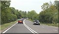
5
The old A46 east of Cotgrave
The A46 was upgraded to a dual carriageway in 2012 Image
Image: © Graham Hogg
Taken: 28 Feb 2017
0.11 miles
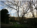
6
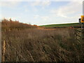
Overgrown settling pond
This pond is designated 4A and receives run-off from the A46.
Image: © Jonathan Thacker
Taken: 20 Dec 2022
0.12 miles
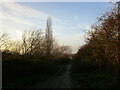
7
Colston Gate
Looking towards the A46 cross roads. In the foreground is a temporary crossing point for works traffic on the improvement scheme. There will only be a simple overbridge at this point, without access to the A46.
Image: © Alan Murray-Rust
Taken: 6 Dec 2009
0.13 miles
10
A46 just south of Colston Gate Cotgrove before opening of the dual carriageway
Image: © Jo and Steve Turner
Taken: 3 Jul 2011
0.16 miles