IMAGES TAKEN NEAR TO
Fosse Way, NOTTINGHAM, NG12 3ER
Introduction
This page details the photographs taken nearby to Fosse Way, NG12 3ER by members of the Geograph project.
The Geograph project started in 2005 with the aim of publishing, organising and preserving representative images for every square kilometre of Great Britain, Ireland and the Isle of Man.

There are currently over 7.5m images from over14,400 individuals and you can help contribute to the project by visiting https://www.geograph.org.uk
Image Map
Images are licensed for reuse under creativecommons.org/licenses/by-sa/2.0
Notes
- Clicking on the map will re-center to the selected point.
- The higher the marker number, the further away the image location is from the centre of the postcode.
Image Listing (21 Images Found)
Images are licensed for reuse under creativecommons.org/licenses/by-sa/2.0
Image
Details
Distance
1
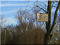
Harwood Farm
A tree provides a suitably prominent location for the farm sign.
Image: © Alan Murray-Rust
Taken: 8 Dec 2009
0.01 miles
2
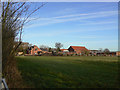
Harwood Farm
Alongside the A46 above Kinoulton.
Image: © Alan Murray-Rust
Taken: 8 Dec 2009
0.02 miles
3
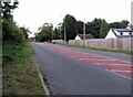
Local traffic road northwards near to Kinoulton Lane
Image: © Andrew Tatlow
Taken: 18 Aug 2020
0.04 miles
4
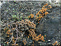
A small army of toadstools
The dark mass to the right can be identified as an old tree stump which is providing sustenance.
From the size, habitat and sheer numbers almost certainly Coprinus disseminatus, aka. Fairies' Bonnets or Trooping Crumble-cap - thanks to John Myers for the identification.
Image: © Alan Murray-Rust
Taken: 8 Dec 2009
0.06 miles
5
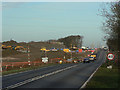
Roehoe junction
This will be the first interchange north of the A606 junction at Widmerpool and will provide links to Kinoulton and Laming Gap Lane
Image: © Alan Murray-Rust
Taken: 8 Dec 2009
0.06 miles
6
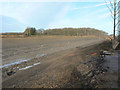
A46 cutting near Widmerpool
The new alignment to the north of the A606 junction is slightly to the west of the existing road, which is to the right of the picture.
Image: © Alan Murray-Rust
Taken: 8 Dec 2009
0.10 miles
7
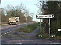
A46 at Kinoulton Lane
The new alignment is just behind the bushes at the left hand side.
Image: © Alan Murray-Rust
Taken: 8 Dec 2009
0.12 miles
9
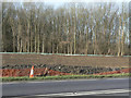
Roehoe Wood
This wood has been significantly depleted by land take for the A46, but gives its name to the new interchange immediately to the north.
Image: © Alan Murray-Rust
Taken: 8 Dec 2009
0.13 miles