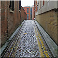
1
Former St. Mary's Parish Centre, Barker Gate, Nottingham
Image: © Andrew Abbott
Taken: 4 Apr 2010
0.01 miles
2
Duke's Place, Hockley, Nottingham 1
There is every reason to suppose that the building on the right was a former Baptist Chapel that was converted into St Mary's School in 187, whilst the building on the left was a 'new' extension for the school that was designed by the well-known local architect Thomas Chambers Hine. Duke's Place is a cul-de-sac and the parked car is facing the busy A60 approximately 150 metres away.
Image: © David Hallam-Jones
Taken: 2 Jan 2017
0.01 miles
3
Memorial to the Pettinger family.
In St. Mary's rest garden, Barker Gate, Nottingham.
Image: © Andrew Abbott
Taken: 4 Apr 2010
0.01 miles
4
17 Barker Gate, Nottingham
A dignified pedimented front of c1834, rebuilt in 1905, next to a former boys' school by Thomas Chambers Hine, 1874.
Both buildings were altered in conversion to offices for architects Maber Associates in 1991.
Image: © Stephen Richards
Taken: 18 Jun 2012
0.01 miles
5
Barker Gate Rest Garden, Hockley, Nottingham 1
Immediately behind these railings is the small rest garden (a.k.a. former burial ground). In the spring of 2016 The Women's Institute submitted a bid for £12,050 of improvements to this green space. Their project aims to equip the space with new garden furniture and to generally improve the horticultural environment. It is anticipated that the W.I. will coordinate the project, with support from the Parks and Open Spaces Service. Another gated entrance/exit can be found at the end of a footpath parallel with the side of a new-build apartment block on Woolpack Lane called The Habitat on Barker Gate. The building seen here seems likely to have been a former lace-finishing factory.
Image: © David Hallam-Jones
Taken: 2 Jan 2017
0.01 miles
6
Wet cobbles in Maiden Lane
Looking from Barker Gate to Woolpack Lane on an unpleasantly cold and wet June afternoon in The Lace Market.
Image: © John Sutton
Taken: 28 Jun 2017
0.01 miles
7
Maiden Lane
The back streets of The Lace Market.
Image: © David Lally
Taken: 21 Jun 2012
0.01 miles
8
St. Mary's rest garden, Barker Gate, Nottingham
Image: © Andrew Abbott
Taken: 4 Apr 2010
0.02 miles
9
Gothic House, Barker Gate, Nottingham
Image: © Andrew Abbott
Taken: 4 Apr 2010
0.02 miles
10
Barker Gate, Nottingham
Image: © Andrew Abbott
Taken: 4 Apr 2010
0.02 miles


