1
Nottingham - NG1 (Sneinton)
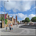
A view across a section of Gedling Street that no longer exists. The car parking and open-market trading area, that can still be seen via the 2008 on-line street-view images provided by a well-known search engine provider, no longer exist either. Instead, a rather soulless pedestrianised area is all that remains but with limited market-trading opportunities continuing in the adjacent indoor market area.
Image: © David Hallam-Jones
Taken: 7 May 2012
0.01 miles
2
Sneinton Market Place and Victoria Leisure Centre
Early on what was to be a very hot and sunny June day.
Image: © John Sutton
Taken: 30 Jun 2015
0.01 miles
3
Victoria Leisure Centre
There is an OS benchmark
Image on the right hand corner of the building, front face
Image: © Roger Templeman
Taken: 14 Aug 2015
0.01 miles
4
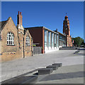
The Ragged School and Victoria Leisure Centre
A view from the corner of Sneinton Market Place on a hot and sunny June morning. The Bulwell stone Ragged School of 1858 is Grade II listed: http://www.britishlistedbuildings.co.uk/en-454869-town-mission-ragged-school-and-attached-#.VZZadiiwHZY .
Image: © John Sutton
Taken: 30 Jun 2015
0.01 miles
5
The corner of Sneinton Market Place
Looking past the former Ragged School towards the Victoria Leisure Centre (originally Victoria Baths), The Bath Inn and Robin Hood Street as stallholders were setting up a little after 9.15 on a sunny Saturday morning in early June.
Image: © John Sutton
Taken: 3 Jun 2017
0.01 miles
6
Victoria Leisure Centre, Nottingham
Originally the Victoria Baths, this building opened in 1850 and housed the first public swimming pool in Nottingham. Less happily, in 1918 it was used as a morgue for victims of the Spanish flu outbreak. By the early part of the 21st century the facilities had become outdated and there was a threat of closure; in the end the baths were completely rebuilt, incorporating a new 25m pool and a gym, but the original tower was retained. It is now called the Victoria Leisure Centre.
Image: © Stephen McKay
Taken: 16 Oct 2022
0.01 miles
7
Victoria Leisure Centre, Bath Street, Nottingham
By the Borough Engineer, Arthur Brown, 1895-96, and dominated by its clock tower.
See also
Image
Image: © Stephen Richards
Taken: 19 Jun 2015
0.01 miles
8
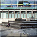
Game on at Victoria Leisure Centre
The steps outside the former Victoria Baths early on a bright August morning.
Image: © John Sutton
Taken: 22 Aug 2015
0.02 miles
9
The Victoria Leisure Centre
Built in 1850 as the first public swimming pool in Nottingham. It has been extensively modernised and now houses a 25m pool and gymnasium.
Image: © Graham Hogg
Taken: 20 Apr 2024
0.02 miles
10
Decorative railings
From inside the Nottingham City Bike Park on Sneinton Marketplace.
Image: © David Lally
Taken: 7 Nov 2022
0.02 miles


