IMAGES TAKEN NEAR TO
Summerwood Lane, NOTTINGHAM, NG11 9DR

Introduction

This page details the photographs taken nearby to Summerwood Lane, NG11 9DR by members of the Geograph project.

The Geograph project started in 2005 with the aim of publishing, organising and preserving representative images for every square kilometre of Great Britain, Ireland and the Isle of Man.

There are currently over 7.5m images from over14,400 individuals and you can help contribute to the project by visiting https://www.geograph.org.uk

Image Map


Images are licensed for reuse under creativecommons.org/licenses/by-sa/2.0
Notes
  • Clicking on the map will re-center to the selected point.
  • The higher the marker number, the further away the image location is from the centre of the postcode.

Image Listing (12 Images Found)

Images are licensed for reuse under creativecommons.org/licenses/by-sa/2.0
Image
Details
Distance
1
View towards Summerwood Lane
The open area used to be the playing fields of Fairham School, but are now general open space. The footpath is a signed right of way, created as recently as 2008.
Image: © Alan Murray-Rust Taken: 28 May 2010
0.02 miles
2
Green on Summerwood Lane
Such small open spaces were typical of Local Authority housing developments in the early post-war years. Nowadays the policy appears to be to crowd as many houses as possible into a given space.
Image: © Alan Murray-Rust Taken: 28 May 2010
0.03 miles
3
Allotments off Summerwood Lane
Seen from the footpath in the adjacent fields.
Image: © Alan Murray-Rust Taken: 28 May 2010
0.12 miles
4
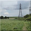
Path and pylons
Next to the Summerwood Lane allotments.
Image: © David Lally Taken: 26 Apr 2017
0.13 miles
5
Fairham Brook nature reserve (1)
The tranquility of this small nature reserve on the edge of Clifton estate is somewhat negated by the twin sets of power lines with their associated pylons striding through.
Image: © Richard Vince Taken: 26 Sep 2013
0.16 miles
6
Edge of Clifton Estate
Houses on Farnborough Road seen from the Fairham Brook Nature Reserve.
Image: © Alan Murray-Rust Taken: 28 May 2010
0.18 miles
7
Thistledown Road
Typical road in the extensive Clifton Estate.
Image: © Alan Murray-Rust Taken: 28 May 2010
0.18 miles
8
Postbox on Summerwood Lane
Reference no. NG11 394, opposite Thistledown Road. Like all the postboxes on the estate, it carries the EIIR monogram.
Image: © Alan Murray-Rust Taken: 28 May 2010
0.19 miles
9
Fairham Brook
Flowing out from the Moors south of Nottingham into the River Trent. The section past Clifton Estate has been designated as a Nature Reserve.
Image: © Alan Murray-Rust Taken: 28 May 2010
0.19 miles
10
Fairham Brook nature reserve (2)
The nearer line of trees conceals the stream that lends its name to the nature reserve. Inevitably, one set of power lines has encroached on the view (see Image).
Image: © Richard Vince Taken: 26 Sep 2013
0.19 miles