IMAGES TAKEN NEAR TO
New Rise, NOTTINGHAM, NG11 8ES
Introduction
This page details the photographs taken nearby to New Rise, NG11 8ES by members of the Geograph project.
The Geograph project started in 2005 with the aim of publishing, organising and preserving representative images for every square kilometre of Great Britain, Ireland and the Isle of Man.

There are currently over 7.5m images from over14,400 individuals and you can help contribute to the project by visiting https://www.geograph.org.uk
Image Map
Images are licensed for reuse under creativecommons.org/licenses/by-sa/2.0
Notes
- Clicking on the map will re-center to the selected point.
- The higher the marker number, the further away the image location is from the centre of the postcode.
Image Listing (76 Images Found)
Images are licensed for reuse under creativecommons.org/licenses/by-sa/2.0
Image
Details
Distance
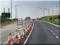
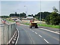
2
Mill Hill site compound off Fox Covert Lane
To the left there will be a complex junction including access to the new tramway park and ride site.
Image: © Alan Murray-Rust
Taken: 21 Feb 2013
0.11 miles
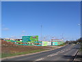
3
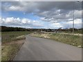
Fox Covert Lane
On Mill Hill, Clifton, Nottinghamshire.
Image: © Andrew Abbott
Taken: 8 Mar 2020
0.12 miles
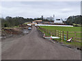
5
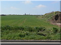
Green fields for green transport
This area is earmarked for a large Park & Ride site as the terminus of the proposed Clifton tram route.
Image: © Alan Murray-Rust
Taken: 19 Apr 2009
0.12 miles
7
Lark Hill retirement village
Being built on the edge of Clifton. I am uncomfortable about the building of ghettos for our elderly.
Image: © Tim Heaton
Taken: 30 Mar 2008
0.15 miles
8
Lark Hill Village
An extensive development of 327 dwellings for elderly persons created by the Extra Care Trust in cooperation with Nottingham City Council and Nottingham City NHS Primary Care Trust.
Image: © Alan Murray-Rust
Taken: 28 May 2010
0.17 miles
9
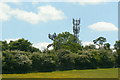
Mill Hill
No mill on the hill, just a couple of telecommunications masts, one of which tries to disguise itself as a sort of pine tree.
Image: © Alan Murray-Rust
Taken: 28 May 2010
0.17 miles
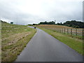
10
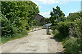
Top of Fox Covert Lane
This is a public bridleway, vehicles are restricted to private access to Burrows Farm and a number of riverside cottages along the River Trent.
Image: © Alan Murray-Rust
Taken: 28 May 2010
0.17 miles