
IMAGES TAKEN NEAR TO
Thorold Close, NOTTINGHAM, NG11 8BU
Introduction
This page details the photographs taken nearby to Thorold Close, NG11 8BU by members of the Geograph project.
The Geograph project started in 2005 with the aim of publishing, organising and preserving representative images for every square kilometre of Great Britain, Ireland and the Isle of Man.

There are currently over 7.5m images from over14,400 individuals and you can help contribute to the project by visiting https://www.geograph.org.uk
Image Map
Images are licensed for reuse under creativecommons.org/licenses/by-sa/2.0
Notes
- Clicking on the map will re-center to the selected point.
- The higher the marker number, the further away the image location is from the centre of the postcode.
Image Listing (25 Images Found)
Images are licensed for reuse under creativecommons.org/licenses/by-sa/2.0
Image
Details
Distance
1
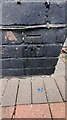
Benchmark on front of #78 Green Lane
Ordnance Survey cut mark benchmark levelled at 49.378m above Newlyn Datum verified 1962
Image: © Roger Templeman
Taken: 26 Jun 2023
0.09 miles
2
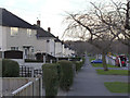
Green Lane, Clifton
This is one of the principal thoroughfares in this large post-war council estate, following the line of a long-standing lane between Clifton Village and Ruddington.
Image: © Alan Murray-Rust
Taken: 13 Feb 2014
0.09 miles
3
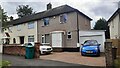
Houses of Green Lane, #78 at right
There is an Ordnance Survey benchmark Image on the black bricks below the pebbledash at the right hand corner of #78
Image: © Roger Templeman
Taken: 26 Jun 2023
0.09 miles
4
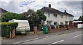
Nos. 1 and 3 Dalehead Road
Ordnance Survey documents indicate that a benchmark levelled at 42.264m above Newlyn Datum was verified in 1962 on the right hand end of the wall next to the metal gate beside the front corner of the nearer house
Image: © Roger Templeman
Taken: 26 Jun 2023
0.19 miles
5
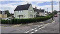
Houses of Gardendale Avenue (#12 nearest) at Dalehead Road junction
Ordnance Survey documents indicate that a benchmark levelled at 45.232m above Newlyn Datum was verified in 1962 on the right hand end of the wall in #12's garden
Image: © Roger Templeman
Taken: 26 Jun 2023
0.19 miles
6
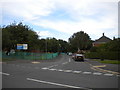
South east end of Langstrath Road, Clifton estate
Seen from Green Lane.
Image: © Richard Vince
Taken: 26 Sep 2013
0.20 miles
7
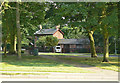
The Forge, Glapton Lane
One of the very few remaining buildings of the hamlet of Glapton which got subsumed into the huge Clifton Estate.
Image: © Alan Murray-Rust
Taken: 29 May 2009
0.20 miles
9
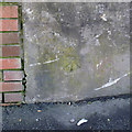
Bench mark, Donington Road
See http://www.geograph.org.uk/photo/3851802 for location.
Image: © Alan Murray-Rust
Taken: 13 Feb 2014
0.21 miles
10
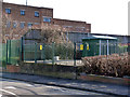
Electricity substation on Donington Road
The original building has been replaced by a modern box.
There is a bench mark http://www.geograph.org.uk/photo/3851799 at the far end of the concrete base.
Image: © Alan Murray-Rust
Taken: 13 Feb 2014
0.21 miles