
IMAGES TAKEN NEAR TO
Wain Grove, NOTTINGHAM, NG11 7ED
Introduction
This page details the photographs taken nearby to Wain Grove, NG11 7ED by members of the Geograph project.
The Geograph project started in 2005 with the aim of publishing, organising and preserving representative images for every square kilometre of Great Britain, Ireland and the Isle of Man.

There are currently over 7.5m images from over14,400 individuals and you can help contribute to the project by visiting https://www.geograph.org.uk
Image Map
Images are licensed for reuse under creativecommons.org/licenses/by-sa/2.0
Notes
- Clicking on the map will re-center to the selected point.
- The higher the marker number, the further away the image location is from the centre of the postcode.
Image Listing (150 Images Found)
Images are licensed for reuse under creativecommons.org/licenses/by-sa/2.0
Image
Details
Distance
1
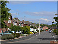
The Downs, Silverdale
The bottom end of this estate, which is a bit sidelined by having only a single access onto the main road network.
Image: © Alan Murray-Rust
Taken: 21 May 2009
0.02 miles
2
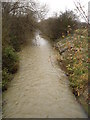
Fairham Brook, Clifton
This small stream separates the Clifton and West Bridgford areas of Nottingham, running north to debouch into the Trent at Clifton Bridge. On this cold December's morning it was flowing fast and was completely opaque, full of mud.
Image: © Oxymoron
Taken: 5 Dec 2008
0.04 miles
3
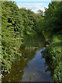
Fairham Brook
From the Silverdale Walk footbridge. A clear and placid stream in this view, it can be more turbulent at times, as in this view taken from the same bridge looking in the other direction Image
Image: © Alan Murray-Rust
Taken: 21 May 2009
0.05 miles
4
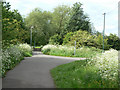
Silverdale Walk
The main footpath turns right at this point and crosses the Fairham Brook. Straight ahead the footpath rejoins the Clifton Estate.
Image: © Alan Murray-Rust
Taken: 21 May 2009
0.07 miles
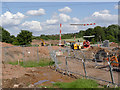
6
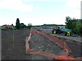
At the back of Silverdale
The new alignment towards Clifton is well under way.
Image: © Alan Murray-Rust
Taken: 19 Sep 2012
0.08 miles
7
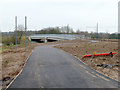
Pathway to the City, and Fairham Brook bridge
The pathway is part of a completely new foot and cycle link paralleling the tramway right through to the City.
Image: © Alan Murray-Rust
Taken: 11 Mar 2015
0.08 miles
8
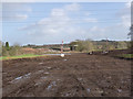
Across the Fairham Brook
The full alignment of the tramway across the fields below Silverdale Estate is now clearly defined by topsoil removal.
Image: © Alan Murray-Rust
Taken: 30 Jan 2013
0.08 miles
9
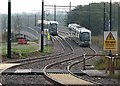
Trams crossing Fairham Brook
A foreshortened zoom shot taken from the cycle path beside the tramway near Farnborough Road. The first part of the morning was cloudy, but the sun was about to break through.
Image: © John Sutton
Taken: 10 Sep 2015
0.08 miles
10
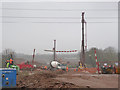
Progress at Fairham Brook bridge
Augers are drilling for the piling of the bridge abutments.
Image: © Alan Murray-Rust
Taken: 12 Apr 2013
0.08 miles