
IMAGES TAKEN NEAR TO
Ruddington Lane, NOTTINGHAM, NG11 7DL
Introduction
This page details the photographs taken nearby to Ruddington Lane, NG11 7DL by members of the Geograph project.
The Geograph project started in 2005 with the aim of publishing, organising and preserving representative images for every square kilometre of Great Britain, Ireland and the Isle of Man.

There are currently over 7.5m images from over14,400 individuals and you can help contribute to the project by visiting https://www.geograph.org.uk
Image Map
Images are licensed for reuse under creativecommons.org/licenses/by-sa/2.0
Notes
- Clicking on the map will re-center to the selected point.
- The higher the marker number, the further away the image location is from the centre of the postcode.
Image Listing (63 Images Found)
Images are licensed for reuse under creativecommons.org/licenses/by-sa/2.0
Image
Details
Distance
1
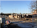
New housing build on the Becket School site
This replaces the last of the former school buildings to be demolished.
Image: © Alan Murray-Rust
Taken: 16 Dec 2012
0.01 miles
2
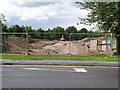
Becket School site redevelopment
A new roadway for the housing development under construction.
Image: © Alan Murray-Rust
Taken: 30 Jul 2012
0.02 miles
3
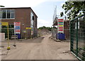
Becket School site
On the left is the last remaining school building. New housing build is well under way on the northern section of the site, to the right.
Image: © Alan Murray-Rust
Taken: 27 Jun 2012
0.03 miles
4
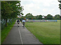
Footpath and cycleway
Linking Ruddington Lane with Compton Acres.
Image: © Alan Murray-Rust
Taken: 29 May 2009
0.07 miles
5
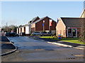
Kenny Avenue
Part of the new housing on the former Becket School site, now in the process of being occupied. The estate has the name Ruddington Place.
Image: © Alan Murray-Rust
Taken: 16 Dec 2012
0.08 miles
7
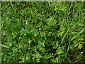
Unidentified yellow trefoil
Possibly Common Yellow Trefoil or else Black Medic.
Image: © Alan Murray-Rust
Taken: 29 May 2009
0.09 miles
10
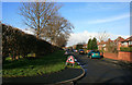
Down to the main path
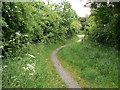
The former railway alignment is crossed here by a main path linking the Wilford Hill (Compton Acres) estate with Ruddington Lane. The old embankment has already been cut away at this point, but it will be entirely removed for the proposed tramway extension to Clifton which will run at the normal ground level. There will be a tram stop at this location.
Image: © Alan Murray-Rust
Taken: 29 May 2009
0.11 miles