
IMAGES TAKEN NEAR TO
Recreation Street, NOTTINGHAM, NG10 2DW
Introduction
This page details the photographs taken nearby to Recreation Street, NG10 2DW by members of the Geograph project.
The Geograph project started in 2005 with the aim of publishing, organising and preserving representative images for every square kilometre of Great Britain, Ireland and the Isle of Man.

There are currently over 7.5m images from over14,400 individuals and you can help contribute to the project by visiting https://www.geograph.org.uk
Image Map
Images are licensed for reuse under creativecommons.org/licenses/by-sa/2.0
Notes
- Clicking on the map will re-center to the selected point.
- The higher the marker number, the further away the image location is from the centre of the postcode.
Image Listing (141 Images Found)
Images are licensed for reuse under creativecommons.org/licenses/by-sa/2.0
Image
Details
Distance
1
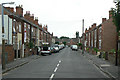
Recreation Street
Terraced housing from around the turn of the 20th century. The name comes from the old recreation ground on the north side of Station Street, which later became Long Eaton Stadium.
Image: © Alan Murray-Rust
Taken: 24 Jun 2010
0.03 miles
2
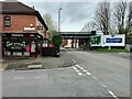
Open and shut
While the poster on the right promotes a newly opened Wickes store in Long Eaton, Tennant's chip shop on the left served its last fish two days before this shot was taken. It was first opened in 1943.
Image: © David Lally
Taken: 8 Apr 2024
0.08 miles
3

Springfield Avenue, Long Eaton
From Station Road.
Image: © Andrew Abbott
Taken: 24 May 2020
0.08 miles

5
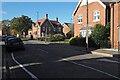
Station Road
With the Circuit Drive estate on the right, so called as it occupies the former site of Long Eaton Stadium; home of the local speedway team https://en.wikipedia.org/wiki/Long_Eaton_Speedway. This is an update of Image taken 11 years before.
Image: © David Lally
Taken: 4 Nov 2021
0.09 miles
6
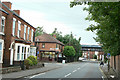
Station Road, Long Eaton
The station was not on the railway which crosses on the bridge. This carried the freight lines built to enable the heavy coal trains to London to bypass the complexities of Trent Junction, the intersection of main lines from London, Nottingham, Derby and Sheffield.
Image: © Alan Murray-Rust
Taken: 24 Jun 2010
0.09 miles
7
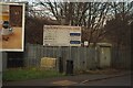
Outdated sign
The stadium industrial park was demolished five years ago.
Image: © David Lally
Taken: 10 Jan 2021
0.09 miles
8
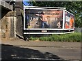
Channel 4 billboard
The, no doubt deliberate, cruciform nature of the image is reinforced by the shadow of the hoarding strip light.
Image: © David Lally
Taken: 20 May 2019
0.09 miles
9

New housing
On Station Road, Long Eaton
Image: © Andrew Abbott
Taken: 24 May 2020
0.09 miles
10
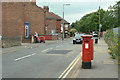
Station Road postbox Ref: NG10 12
Standard GR pillar box which probably dates from the early years of the reign.
Image: © Alan Murray-Rust
Taken: 24 Jun 2010
0.10 miles