
IMAGES TAKEN NEAR TO
Worrall Avenue, NOTTINGHAM, NG10 1NR
Introduction
This page details the photographs taken nearby to Worrall Avenue, NG10 1NR by members of the Geograph project.
The Geograph project started in 2005 with the aim of publishing, organising and preserving representative images for every square kilometre of Great Britain, Ireland and the Isle of Man.

There are currently over 7.5m images from over14,400 individuals and you can help contribute to the project by visiting https://www.geograph.org.uk
Image Map
Images are licensed for reuse under creativecommons.org/licenses/by-sa/2.0
Notes
- Clicking on the map will re-center to the selected point.
- The higher the marker number, the further away the image location is from the centre of the postcode.
Image Listing (271 Images Found)
Images are licensed for reuse under creativecommons.org/licenses/by-sa/2.0
Image
Details
Distance
1
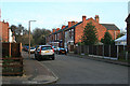
Worrall Avenue
Off Cranmer Street, Long Eaton.
Image: © David Lally
Taken: 31 Jan 2009
0.02 miles
2
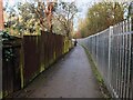
The Nutbrook Trail
Squeezed between an old railway embankment and the houses on the cul-de-sacs off Cranmer Street.
The fence on the right is a new addition.
Image: © David Lally
Taken: 12 Jan 2021
0.03 miles
3
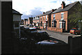
Olive Avenue, Long Eaton
Viewed from the Nutbrook Trail
Image: © David Lally
Taken: 6 Apr 2008
0.05 miles
4
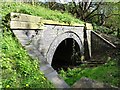
The mouth of culvert TCC/6A
The mouth of a drainage culvert under a disused railway.
Image: © Ian Calderwood
Taken: 2 Apr 2017
0.05 miles
5
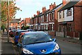
Hemlock Street, Long Eaton
Short street of late Victorian or Edwardian semi-detached villas.
Image: © David Lally
Taken: 2 Nov 2009
0.06 miles
6
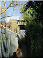
Footpath beneath a disused railway bridge
Image: © Jonathan Thacker
Taken: 26 Jan 2022
0.06 miles
7
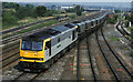
EWS coal train at Toton Yard
An EWS Class 60 departs Toton Yard, near Nottingham with an empty mgr coal train. This was at its peak a busy marshalling yard for the regions coal traffic. Parts of the yard are still in use. The derelict control tower is visible in the middle distance (just above the first wagon).
Image: © Mr B Wilder
Taken: Unknown
0.06 miles
9
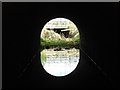
View through bridge/culvert TCC/6A
The view through a culvert under a disused railway to the active railway beyond.
Image: © Ian Calderwood
Taken: 2 Apr 2017
0.06 miles
10
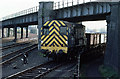
Trip Freight
08757 brings a short trip freight into Toton yards. The line used to serve sidings and presumably factories just under the bridge. The buildings behind the loco have been replaced by a modern warehouse. The gasometer visible through the arches of the bridge on the left has been removed though the site appears to still be a gas pumping station. The bridge was still in use when the photo was taken, but is now overgrown and the tracks have been removed.
Image: © Martin Addison
Taken: 7 Apr 1979
0.06 miles