IMAGES TAKEN NEAR TO
Stretford Court, GATESHEAD, NE9 6LU
Introduction
This page details the photographs taken nearby to Stretford Court, NE9 6LU by members of the Geograph project.
The Geograph project started in 2005 with the aim of publishing, organising and preserving representative images for every square kilometre of Great Britain, Ireland and the Isle of Man.

There are currently over 7.5m images from over14,400 individuals and you can help contribute to the project by visiting https://www.geograph.org.uk
Image Map
Images are licensed for reuse under creativecommons.org/licenses/by-sa/2.0
Notes
- Clicking on the map will re-center to the selected point.
- The higher the marker number, the further away the image location is from the centre of the postcode.
Image Listing (20 Images Found)
Images are licensed for reuse under creativecommons.org/licenses/by-sa/2.0
Image
Details
Distance
2
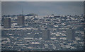
Harlow Green
View from Old Ravensworth looking across the Team Valley towards Harlow Green in Gateshead.
Image: © Peter McDermott
Taken: 28 Nov 2010
0.03 miles
3
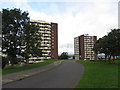
Colourful houses on Woodford
The two tower blocks are Barford Court (to the left) and Stretford Court. Smithy Lane in the foreground.
Image: © Oliver Dixon
Taken: 26 Jul 2018
0.06 miles
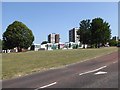
4

Esso filling station on east side of A167
Image: © Luke Shaw
Taken: 17 Sep 2022
0.07 miles
6
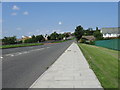
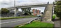
Angel Cycleway
At this point, the Angel Cycleway is a broad tarmac path following the line of a disused railway. The road crossing ahead is of Smithy Lane. Large rocks have been placed to deter motor vehicles on the path.
Image: © Oliver Dixon
Taken: 26 Jul 2018
0.12 miles
7
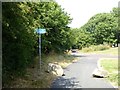
Angel Cycleway
At this point, the Angel Cycleway is a broad tarmac path following the line of a disused railway. The road crossing ahead is of Smithy Lane. Large rocks have been placed to deter motor vehicles on the path.
Image: © Oliver Dixon
Taken: 26 Jul 2018
0.12 miles
8
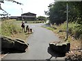
Angel Cycleway
At this point, the Angel Cycleway is a broad tarmac path following the line of a disused railway. Just below the crossing of Smithy Lane.
Image: © Oliver Dixon
Taken: 26 Jul 2018
0.12 miles
9
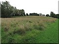
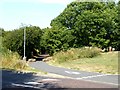
Field looking towards Allerdene
Open field near Allerdene looking north-east towards the housing estate.
Image: © Kevin Hall
Taken: 27 Aug 2012
0.16 miles