
IMAGES TAKEN NEAR TO
Chesters Close, GATESHEAD, NE9 5PB
Introduction
This page details the photographs taken nearby to Chesters Close, NE9 5PB by members of the Geograph project.
The Geograph project started in 2005 with the aim of publishing, organising and preserving representative images for every square kilometre of Great Britain, Ireland and the Isle of Man.

There are currently over 7.5m images from over14,400 individuals and you can help contribute to the project by visiting https://www.geograph.org.uk
Image Map
Images are licensed for reuse under creativecommons.org/licenses/by-sa/2.0
Notes
- Clicking on the map will re-center to the selected point.
- The higher the marker number, the further away the image location is from the centre of the postcode.
Image Listing (51 Images Found)
Images are licensed for reuse under creativecommons.org/licenses/by-sa/2.0
Image
Details
Distance
1

Junction of Joicey Road and Durham Road
Joicey Road runs along the south side of Saltwell Park in Gateshead, and crosses Durham Road, the main route south from the town centre.
Image: © Robert Graham
Taken: 18 Nov 2019
0.04 miles
2
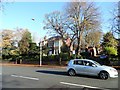
Large houses on Durham Road, Gateshead
This is the Low Fell area of the town, and has been a more affluent area since development started in the 19th century.
Image: © Robert Graham
Taken: 18 Nov 2019
0.04 miles
3
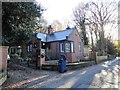
House on East Park Road
This road runs along the east side of Saltwell Park in Gateshead. The bungalow here was built in 1903.
Image: © Robert Graham
Taken: 18 Nov 2019
0.09 miles
4
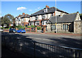
Semi-detached housing in Gateshead
Substantial semi-detached houses on the east side of Durham Road in the Low Fell district of Gateshead. The small, stone built cottage is adjacent to a large property and was perhaps a gatehouse for it.
Image: © Trevor Littlewood
Taken: 9 Oct 2013
0.11 miles
5

Gates to Heathfield House, Gateshead
Heathfield House on Durham Road in the Low Fell area of the town was built in 1856. The house, including the imposing gates seen here, was designed by John Wardle, who also designed The Hancock Museum in Newcastle. Many wealthy industrialists built mansions in Low Fell in the middle of the 19th century, away from the crowded town centre.
Image: © Robert Graham
Taken: 18 Nov 2019
0.13 miles
6
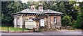
The Lodge, #27 Durham Road at Mulberry Park junction
Image: © Luke Shaw
Taken: 1 Sep 2022
0.14 miles
7
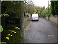
The Drive
A private road leading directly onto Durham Road.
Image: © MSX
Taken: 19 Oct 2005
0.17 miles
8
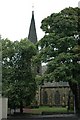
St Helen, Low Fell
St Helen's, Low Fell, was consecrated in 1876 to serve a new parish and
built at the cost of Edward Joicey (colliery owner); this area was an
upcoming suburb where the wealthy industrialists and merchants of
Newcastle and Gateshead were building large houses. Today the area
appears little changed.
The church is in a "mature" churchyard (ie. you can't see it for
trees!) which, being an urban location and postdating the Burial Acts of
the middle of the 19th century, is not a burial ground. It is a very
well maintained and, I was told, well attended church.
It has four windows in the Nave by Morris & Co, three of them from
designs by Sir Edward Burne Jones.
Image: © Gareth Foster
Taken: 10 Sep 2005
0.17 miles
9

Durham Road-A167 (Facing South)
Suburban housing flanks this section of A-Road just before Low Fell.
Image: © MSX
Taken: 19 Oct 2005
0.17 miles
10

Gates to Heathfield House
Grand gates lead to large council property.
Image: © MSX
Taken: 19 Oct 2005
0.17 miles