IMAGES TAKEN NEAR TO
Cartmel Grove, GATESHEAD, NE8 4YZ
Introduction
This page details the photographs taken nearby to Cartmel Grove, NE8 4YZ by members of the Geograph project.
The Geograph project started in 2005 with the aim of publishing, organising and preserving representative images for every square kilometre of Great Britain, Ireland and the Isle of Man.

There are currently over 7.5m images from over14,400 individuals and you can help contribute to the project by visiting https://www.geograph.org.uk
Image Map (Loading...)


Getting Data...Please wait
Leaflet Map data © OpenStreetMap
Images are licensed for reuse under creativecommons.org/licenses/by-sa/2.0
Notes
- Clicking on the map will re-center to the selected point.
- The higher the marker number, the further away the image location is from the centre of the postcode.
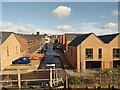
Image Listing (37 Images Found)
Images are licensed for reuse under creativecommons.org/licenses/by-sa/2.0
Image
Details
Distance
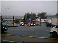
2
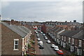
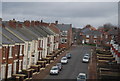
Maxwell Street, Gateshead
Viewed from a High Speed Train held at signals waiting to enter Newcastle Station.
Image: © John Lucas
Taken: 5 Feb 2008
0.09 miles
3
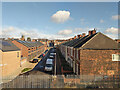
Macadam Street, Gateshead
One of a grid of streets named after 18th and 19th century industrially important engineers and scientists. Kelvin Grove may be seen on the other side of Saltwell Road.
Image: © Robin Webster
Taken: 18 Oct 2019
0.10 miles
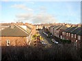
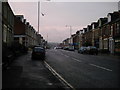
6
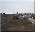
Derelict land, Armstrong St
A bit of "slum" clearance.
Image: © N Chadwick
Taken: 21 Feb 2011
0.11 miles
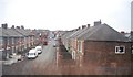
7
Watt Street, Gateshead
One of a grid of streets named after 18th and 19th century industrially important engineers and scientists.
Image: © Robin Webster
Taken: 18 Oct 2019
0.11 miles
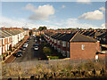
8
Armstrong Street, Gateshead
One of a grid of streets named after 18th and 19th century industrially important engineers and scientists.
Image: © Robin Webster
Taken: 18 Oct 2019
0.12 miles
9
Lobley Hill Junction
Where Bensham Road becomes Lobley Hill Road, at the junction with Saltwell Road.
Image: © MSX
Taken: 27 Oct 2005
0.12 miles
10
Saltwell Road
This main street is almost exactly 50% Residential and 50% Commercial.
Image: © MSX
Taken: 27 Oct 2005
0.12 miles