
IMAGES TAKEN NEAR TO
Beech Street, GATESHEAD, NE8 3ET
Introduction
This page details the photographs taken nearby to Beech Street, NE8 3ET by members of the Geograph project.
The Geograph project started in 2005 with the aim of publishing, organising and preserving representative images for every square kilometre of Great Britain, Ireland and the Isle of Man.

There are currently over 7.5m images from over14,400 individuals and you can help contribute to the project by visiting https://www.geograph.org.uk
Image Map
Images are licensed for reuse under creativecommons.org/licenses/by-sa/2.0
Notes
- Clicking on the map will re-center to the selected point.
- The higher the marker number, the further away the image location is from the centre of the postcode.
Image Listing (27 Images Found)
Images are licensed for reuse under creativecommons.org/licenses/by-sa/2.0
Image
Details
Distance
1
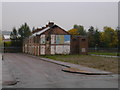
John Street (Remains of)
This whole area is set for demolition. These few houses remain.
Image: © MSX
Taken: 28 Oct 2005
0.04 miles
2
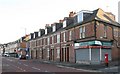
Sunderland Road, B1426
Shows the location of Image
Image: © Mike Quinn
Taken: 3 Nov 2009
0.05 miles
3

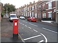
Edward VII postbox, Sunderland Road / Howe Street
Image: © Mike Quinn
Taken: 3 Nov 2009
0.06 miles
4
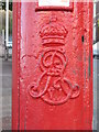
Edward VII postbox, Sunderland Road / Howe Street - royal cipher
See Image
Image: © Mike Quinn
Taken: 3 Nov 2009
0.06 miles
5
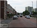
Sunderland Road, Felling
Looking towards the centre of Gateshead from Felling.
Image: © Richard Webb
Taken: 18 Jun 2013
0.07 miles
7
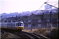
Tyne & Wear Metro approaching Gateshead Stadium
Image: © Malc McDonald
Taken: 20 Feb 1985
0.09 miles
8
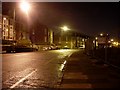
Sunderland Road near Felling
New housing construction taking place to the right of the image.
Image: © Stephen Sweeney
Taken: 8 Jan 2009
0.09 miles
9
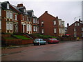
Proud Terracing on Sunderland Road
Across the road from all the demolition is this excellent example of Tyneside Terracing.
Image: © MSX
Taken: 28 Oct 2005
0.10 miles
10
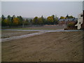
Flattened Neighbourhood
The extent of the demolition is visible here.
Image: © MSX
Taken: 28 Oct 2005
0.10 miles